MyTopo
West Concord Minnesota US Topo Map
Couldn't load pickup availability
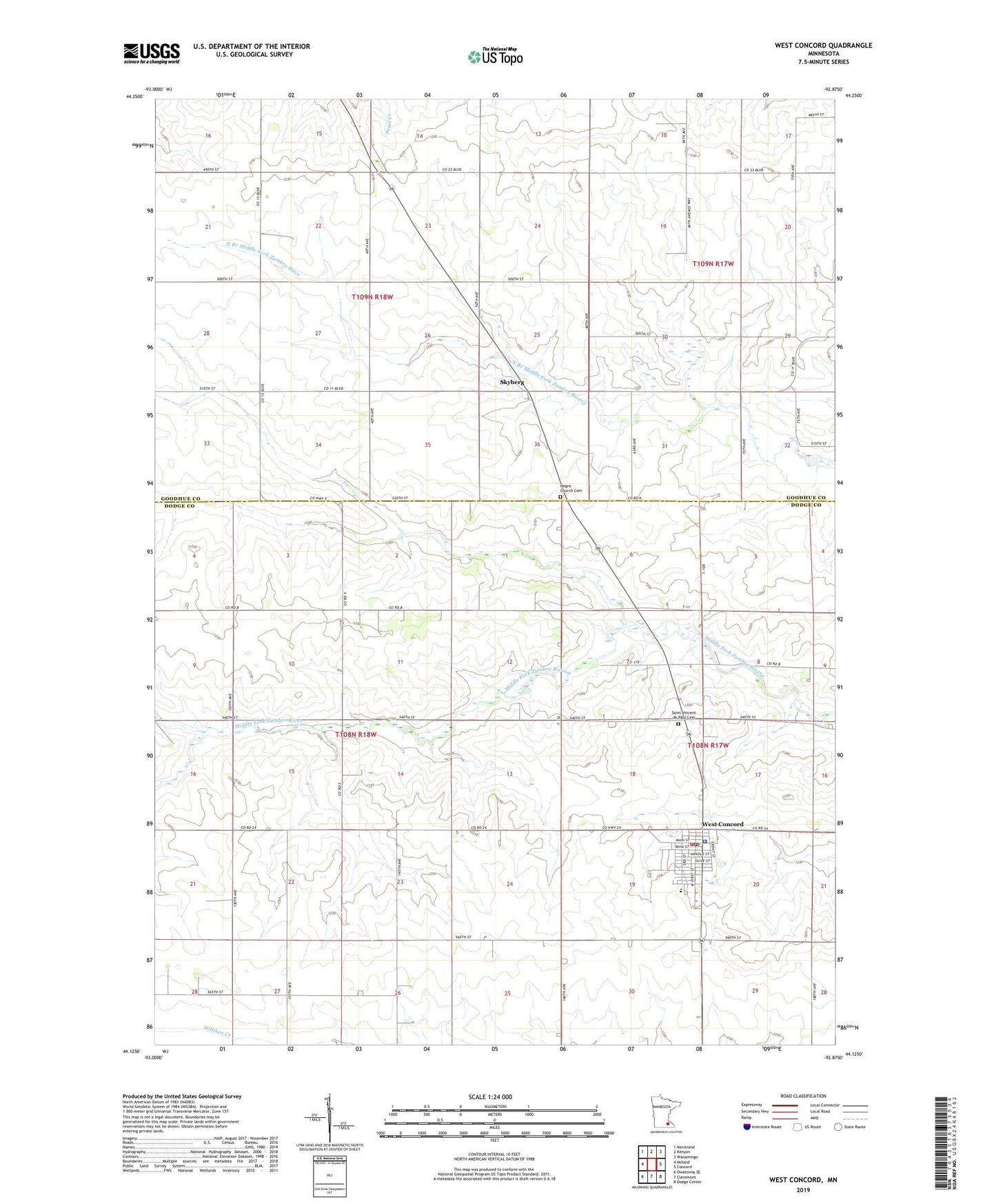
2019 topographic map quadrangle West Concord in the state of Minnesota. Scale: 1:24000. Based on the newly updated USGS 7.5' US Topo map series, this map is in the following counties: Dodge, Goodhue. The map contains contour data, water features, and other items you are used to seeing on USGS maps, but also has updated roads and other features. This is the next generation of topographic maps. Printed on high-quality waterproof paper with UV fade-resistant inks.
Quads adjacent to this one:
West: Moland
Northwest: Nerstrand
North: Kenyon
Northeast: Wanamingo
East: Concord
Southeast: Dodge Center
South: Claremont
Southwest: Owatonna SE
Contains the following named places: City of West Concord, County Ditch Number One, First Baptist Church, Hegre Church Cemetery, Saint Vincent de Paul Cemetery, Skyberg, Skyberg Post Office, Skyberg Wayside Park, Township of Ellington, Township of Kenyon, Trinity Lutheran Church, Triton Intermediate School, Turner Farm, West Concord, West Concord Catholic Church, West Concord City Hall, West Concord Elementary School, West Concord Fire Department, West Concord Library, West Concord Police Department, West Concord Post Office, West Gate Mobile Home Park, ZIP Code: 55985