MyTopo
Current Lake Minnesota US Topo Map
Couldn't load pickup availability
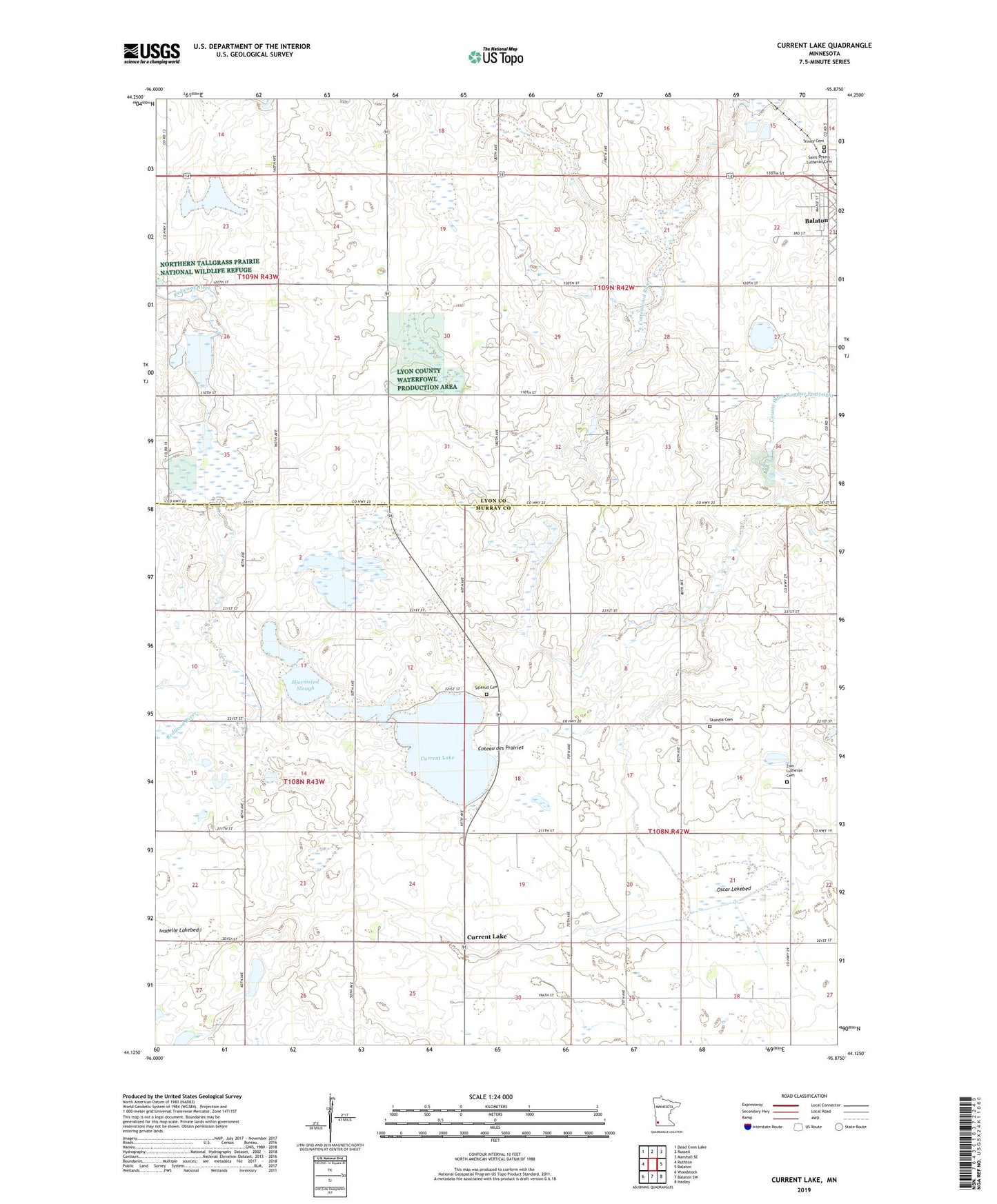
2022 topographic map quadrangle Current Lake in the state of Minnesota. Scale: 1:24000. Based on the newly updated USGS 7.5' US Topo map series, this map is in the following counties: Murray, Lyon. The map contains contour data, water features, and other items you are used to seeing on USGS maps, but also has updated roads and other features. This is the next generation of topographic maps. Printed on high-quality waterproof paper with UV fade-resistant inks.
Quads adjacent to this one:
West: Ruthton
Northwest: Dead Coon Lake
North: Russell
Northeast: Marshall SE
East: Balaton
Southeast: Hadley
South: Balaton SW
Southwest: Woodstock
This map covers the same area as the classic USGS quad with code o44095b8.
Contains the following named places: Bergman State Wildlife Management Area, County Ditch Number Fortyeight, Current Lake, Current Lake Post Office, Current Lake State Wildlife Management Area, Gadwall State Wildlife Management Area, Hjermstad Slough, Nelson State Wildlife Management Area, Oscar Lakebed, Reinhold State Wildlife Management Area, Saint Peter's Evangelical Lutheran School, Saint Peters Lutheran Cemetery, Shelburne State Wildlife Management Area, Sillerud Cemetery, Sillerud Church, Skandia Cemetery, Skandia Church, Township of Rock Lake, Township of Skandia, Trinity Cemetery, Victory Christian Church, Zion Church, Zion Lutheran Cemetery, ZIP Code: 56115