MyTopo
Yucatan Minnesota US Topo Map
Couldn't load pickup availability
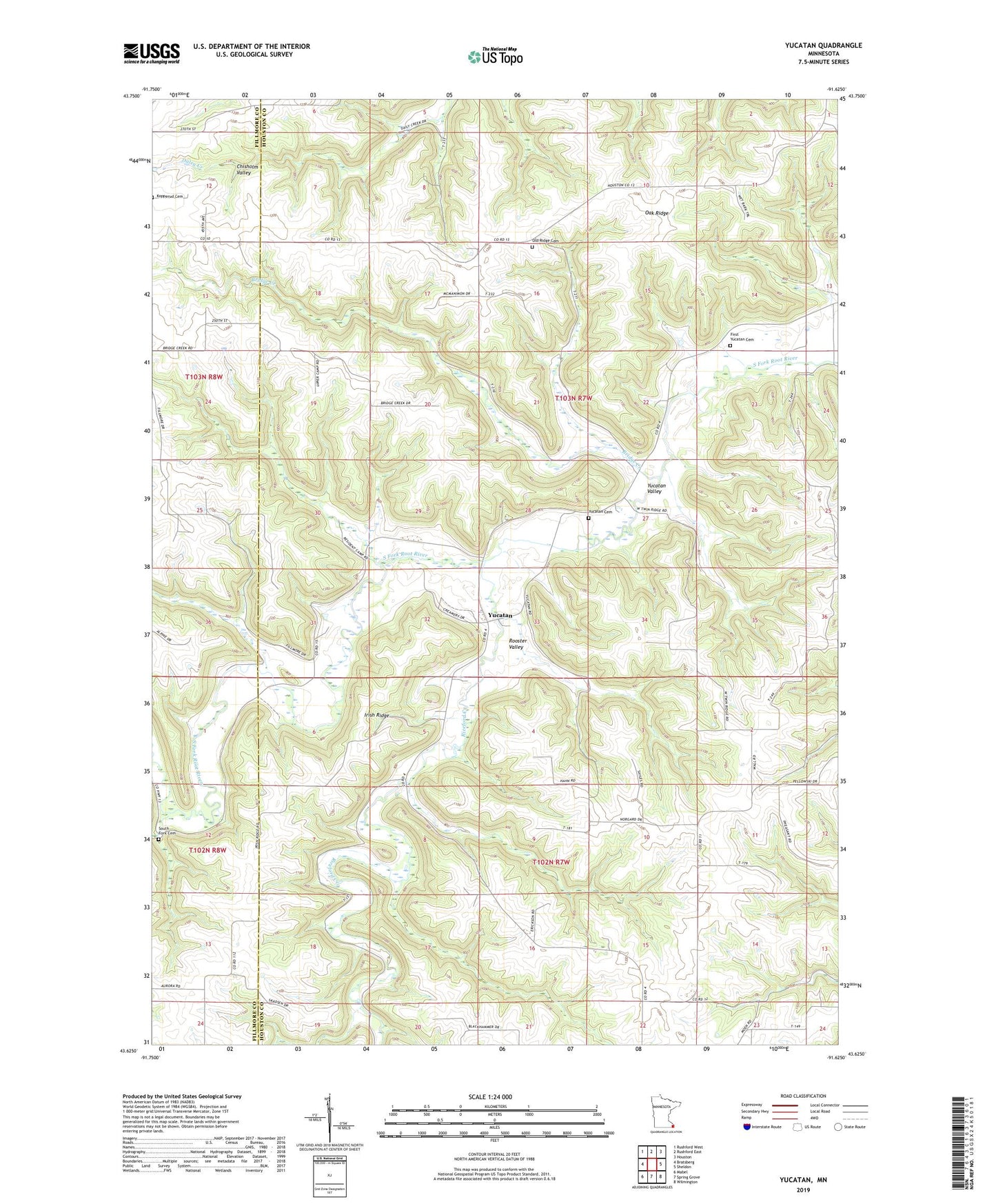
2019 topographic map quadrangle Yucatan in the state of Minnesota. Scale: 1:24000. Based on the newly updated USGS 7.5' US Topo map series, this map is in the following counties: Houston, Fillmore. The map contains contour data, water features, and other items you are used to seeing on USGS maps, but also has updated roads and other features. This is the next generation of topographic maps. Printed on high-quality waterproof paper with UV fade-resistant inks.
Quads adjacent to this one:
West: Bratsberg
Northwest: Rushford West
North: Rushford East
Northeast: Houston
East: Sheldon
Southeast: Wilmington
South: Spring Grove
Southwest: Mabel
Contains the following named places: Bridge Creek, First Yucatan Cemetery, Irish Ridge, Oak Ridge, Oak Ridge Church, Old Ridge Cemetery, Riceford Creek, Rooster Valley, School Number 607, School Number 633, South Fork Cemetery, Thorson Group North Detention Dam, Thorson Group West Detention Dam, Township of Black Hammer, Township of Yucatan, Yucatan, Yucatan Cemetery, Yucatan Post Office, Yucatan Valley