MyTopo
Bratsberg Minnesota US Topo Map
Couldn't load pickup availability
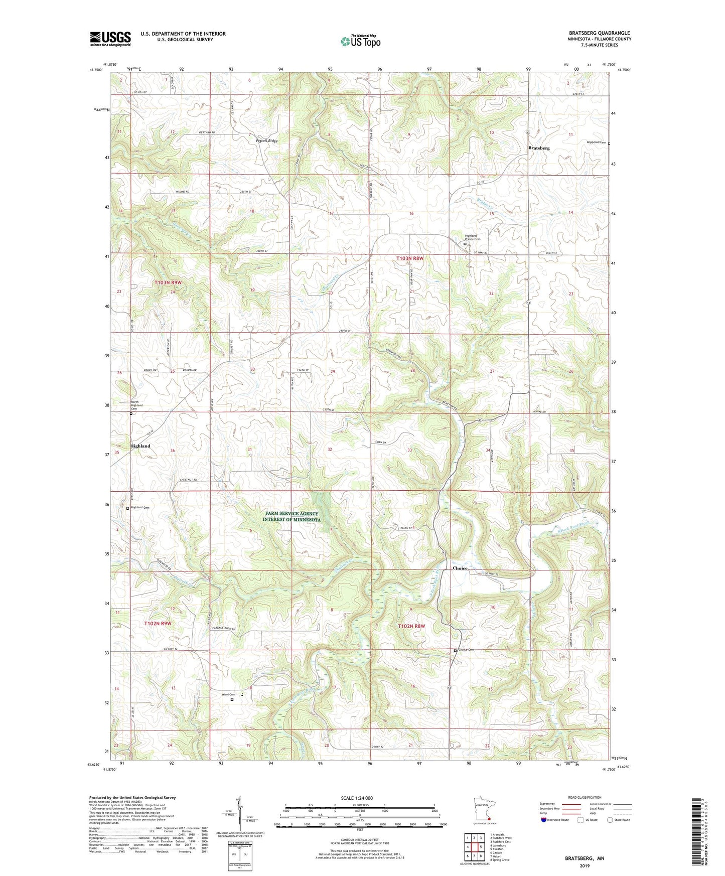
2022 topographic map quadrangle Bratsberg in the state of Minnesota. Scale: 1:24000. Based on the newly updated USGS 7.5' US Topo map series, this map is in the following counties: Fillmore. The map contains contour data, water features, and other items you are used to seeing on USGS maps, but also has updated roads and other features. This is the next generation of topographic maps. Printed on high-quality waterproof paper with UV fade-resistant inks.
Quads adjacent to this one:
West: Lanesboro
Northwest: Arendahl
North: Rushford West
Northeast: Rushford East
East: Yucatan
Southeast: Spring Grove
South: Mabel
Southwest: Canton
This map covers the same area as the classic USGS quad with code o43091f7.
Contains the following named places: Bratsberg, Bratsberg Post Office, Choice, Choice Cemetery, Choice Post Office, Highland, Highland Cemetery, Highland Post Office, Highland Prairie Cemetery, Highland Prairie Church, Kopperud Cemetery, KQYB-FM (Spring Grove), North Highland Cemetery, Pigtail Ridge, School Number 498, School Number 508, Shattuck Creek, Township of Norway, Township of Preble, Vesta Creek, Wisel Cemetery, Wisel Creek