MyTopo
Arcola Mississippi US Topo Map
Couldn't load pickup availability
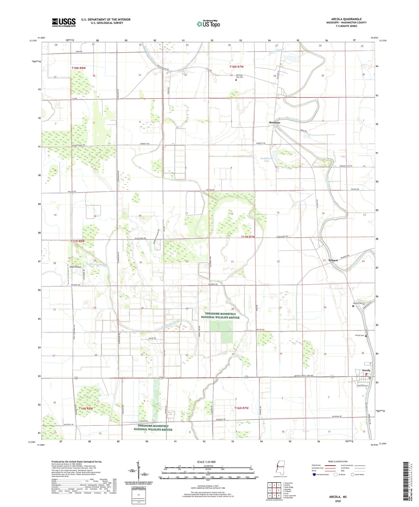
2020 topographic map quadrangle Arcola in the state of Mississippi. Scale: 1:24000. Based on the newly updated USGS 7.5' US Topo map series, this map is in the following counties: Washington. The map contains contour data, water features, and other items you are used to seeing on USGS maps, but also has updated roads and other features. This is the next generation of topographic maps. Printed on high-quality waterproof paper with UV fade-resistant inks.
Quads adjacent to this one:
West: Wayside
Northwest: Greenville
North: Leland
Northeast: Holly Ridge
East: Tribbett
Southeast: Hollandale
South: Swan Lake NW
Southwest: Avon
Contains the following named places: Abide Airpark, Aldridge, Almy, Aqua Farms Dam, Arcola, Arcola Cemetery, Arcola Post Office, Arcola Volunteer Fire Department, Ballard Lake Dam, Bethlehem Church, Burdette, Hays, Huddleston Lake, Isenberg, Johnston, Jones Chapel, L and W Catfish Ponds Dam, Morning Star Cemetery, Morning Star Church, Mount Carmel Church, Mount Galilee Church, Mount Zion Church, New Morning Star Church, New Prosperity Church, Old Morning Star Church, Paxton Cemetery, Quay, Rolling Bayou, Saint Johns Church, Saint Marys Church, Saint Matthews Church, Sligo Plantation, Sunrise Church, Supervisor District 2, Swiftwater Bayou, Town of Arcola, Washington County, Whitehall Plantation, Widow Bayou, Wilmot, Wingfield Lake Dam, ZIP Code: 38722