MyTopo
Benoit Mississippi US Topo Map
Couldn't load pickup availability
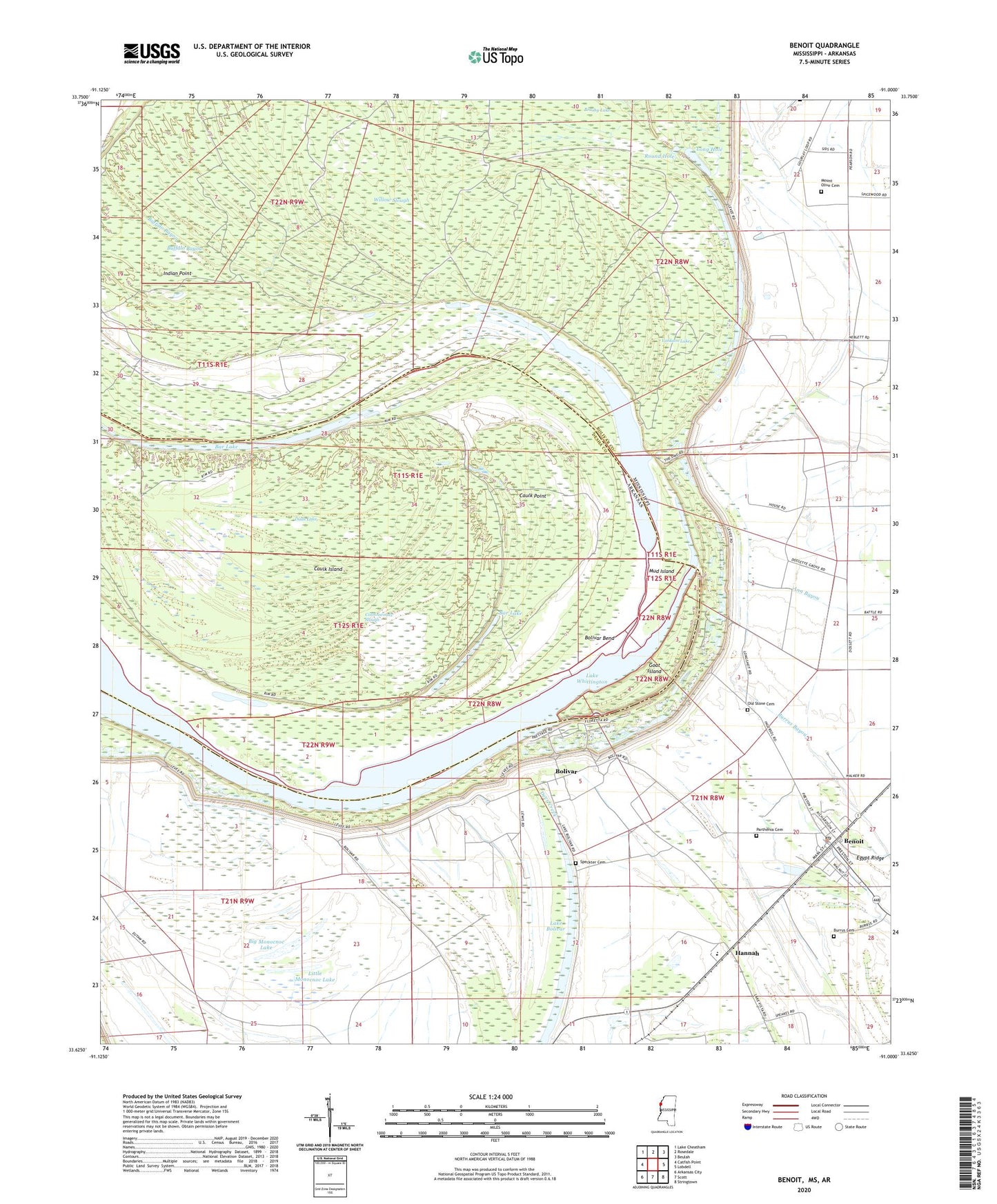
2024 topographic map quadrangle Benoit in the states of Mississippi, Arkansas. Scale: 1:24000. Based on the newly updated USGS 7.5' US Topo map series, this map is in the following counties: Bolivar, Desha. The map contains contour data, water features, and other items you are used to seeing on USGS maps, but also has updated roads and other features. This is the next generation of topographic maps. Printed on high-quality waterproof paper with UV fade-resistant inks.
Quads adjacent to this one:
West: Catfish Point
Northwest: Lake Cheatham
North: Rosedale
Northeast: Beulah
East: Lobdell
Southeast: Stringtown
South: Scott
Southwest: Arkansas City
This map covers the same area as the classic USGS quad with code o33091f1.
Contains the following named places: Bar Lake, Benoit, Benoit High School, Benoit Police Department, Benoit Post Office, Big Monocnoc Lake, Bird Landing, Bold Pilgrim Church, Bolivar, Bolivar Bend, Bolivar Census Designated Place, Bolivar Chute, Bolivar Landing, Brushy Lake, Buckridge Landing, Buffalo Bayou, Burrus Cemetery, Caulk Island, Caulk Point, Cookes Landing, Cottonwoods Slough, Dads Lake, Egypt Ridge, Goat Island, Hannah, Holly Ridge Landing, Home Landing, Indian Point, Jersey Point, Kentucky Landing, Lake Vermilon, Little Monocnoc Lake, Long Hole, Melrose Landing, Mount Olive Cemetery, Mount Olive Church, Mud Island, Niblett Landing, Nugent Center School, Old Stone Cemetery, Parthenia Cemetery, Rising Sun Church, Round Hole, Saint Matthew Church, Speckter Cemetery, Town of Benoit, Willow Slough, Yankum Lake, ZIP Code: 38725