MyTopo
Betheden Mississippi US Topo Map
Couldn't load pickup availability
Also explore the Betheden Forest Service Topo of this same quad for updated USFS data
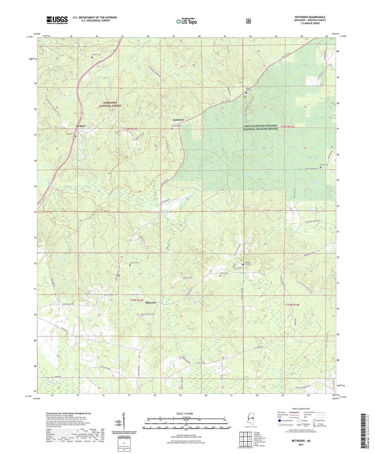
2024 topographic map quadrangle Betheden in the state of Mississippi. Scale: 1:24000. Based on the newly updated USGS 7.5' US Topo map series, this map is in the following counties: Winston. The map contains contour data, water features, and other items you are used to seeing on USGS maps, but also has updated roads and other features. This is the next generation of topographic maps. Printed on high-quality waterproof paper with UV fade-resistant inks.
Quads adjacent to this one:
West: Louisville North
Northwest: Sturgis
North: Bradley
Northeast: Bluff Lake
East: Barge Lake
Southeast: Fearns Springs
South: Boon
Southwest: Louisville South
This map covers the same area as the classic USGS quad with code o33088b8.
Contains the following named places: Antioch Cemetery, Antioch Church, Betheden, Betheden Cemetery, Betheden Lutheran Church, Betheden Volunteer Fire Department, Bevil, Bevil Hill Cemetery, Bevil Hill Church, Deposit, Dry Creek, Glenn Cemetery, Kinard Lake Dam, Liberty Cemetery, Liberty Church, Loakfoma, Millcreek, Mount Olive Church, Mount Pleasant Number 1 Church, Mount Pleasant Number 2 Church, Oliver Cemetery, Pleasant Grove Cemetery, Pleasant Grove Church, Rocky Hill Church, Singleton Church, Supervisor District 3, Webster, Webster Cemetery, White Lake Dam