MyTopo
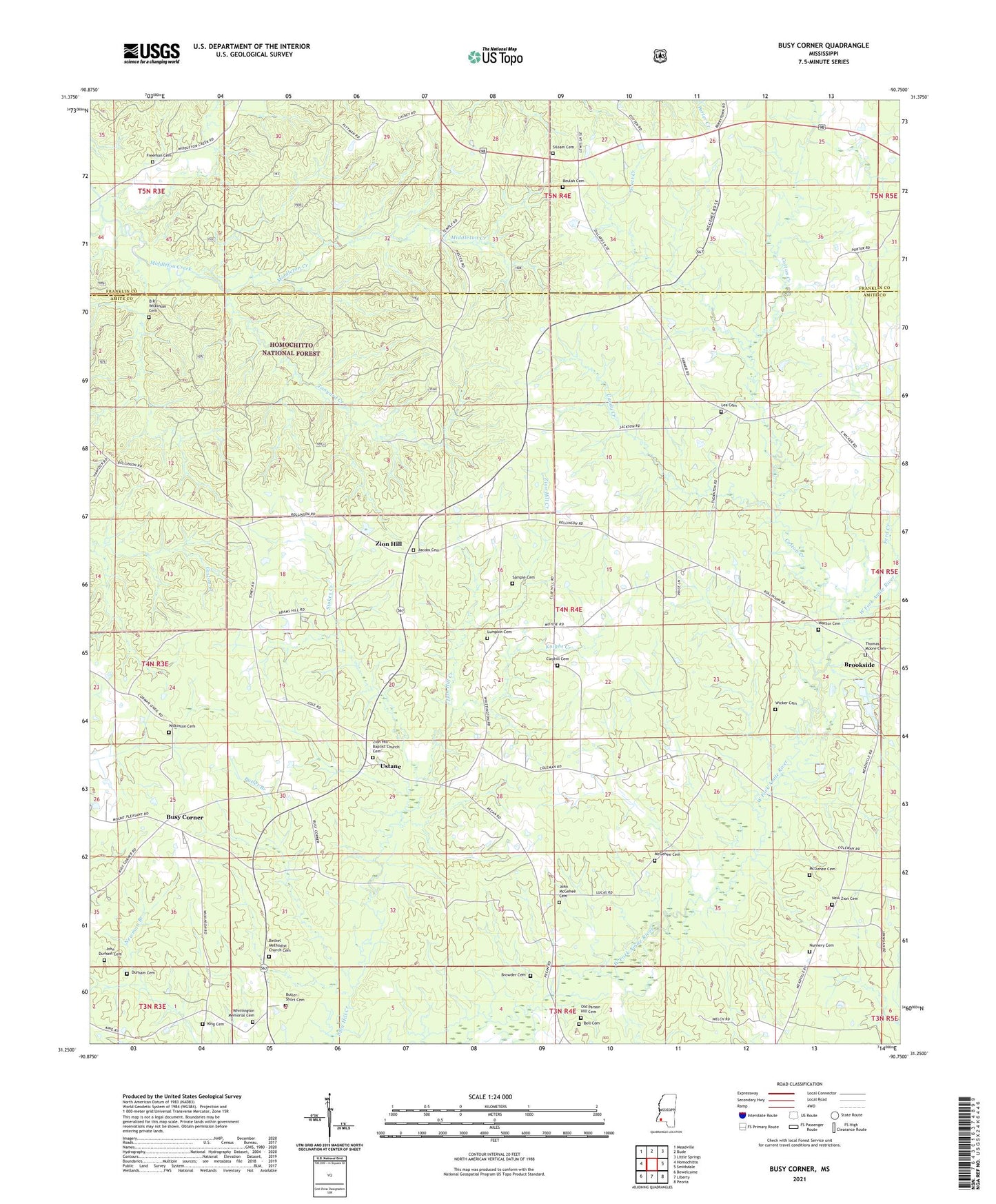
Busy Corner Mississippi US Topo Map
Couldn't load pickup availability
Also explore the Busy Corner Forest Service Topo of this same quad for updated USFS data
2024 topographic map quadrangle Busy Corner in the state of Mississippi. Scale: 1:24000. Based on the newly updated USGS 7.5' US Topo map series, this map is in the following counties: Amite, Franklin. The map contains contour data, water features, and other items you are used to seeing on USGS maps, but also has updated roads and other features. This is the next generation of topographic maps. Printed on high-quality waterproof paper with UV fade-resistant inks.
Quads adjacent to this one:
West: Homochitto
Northwest: Meadville
North: Bude
Northeast: Little Springs
East: Smithdale
Southeast: Peoria
South: Liberty
Southwest: Bewelcome
This map covers the same area as the classic USGS quad with code o31090c7.
Contains the following named places: Amite River Industries Pond Dam, B R Wilkinson Cemetery, Bell Cemetery, Bethel Church, Bethel Methodist Church Cemetery, Bethlehem Church, Beulah Cemetery, Bowlin Lake Dam, Brookside, Browder Cemetery, Busy Corner, Butler - Short Cemetery, Butler Branch, Candy Creek, Clayhill Cemetery, Clayhill Church, Cotton Creek, Durham Cemetery, Ford School, Freeman Cemetery, Hebron, Jacobs Cemetery, John Durham Cemetery, John McGehee Cemetery, King Cemetery, Knight Creek, Lea Cemetery, Lumpkin Cemetery, McGehee Cemetery, New Pine Grove Church, New Salem Church, New Zion Cemetery, New Zion Church, Nunnery Cemetery, Nunnery Store, Old Parson Hill Cemetery, Parson Hill Church, Pine Grove Church, Rose Creek School, Rosehill Church, Sample Cemetery, Scott Creek, Siloam Baptist Church, Siloam Cemetery, Smyrna Church, Stokes Creek, Tanyard Creek, Thomas Moore Cemetery, Ustane, Wactor Cemetery, Whittington, Whittington Church, Whittington Memorial Cemetery, Wicker Cemetery, Wilkinson Cemetery, Williams Chapel, WMAU-TV (Bude), Zion Hill, Zion Hill Baptist Church, Zion Hill Baptist Church Cemetery