MyTopo
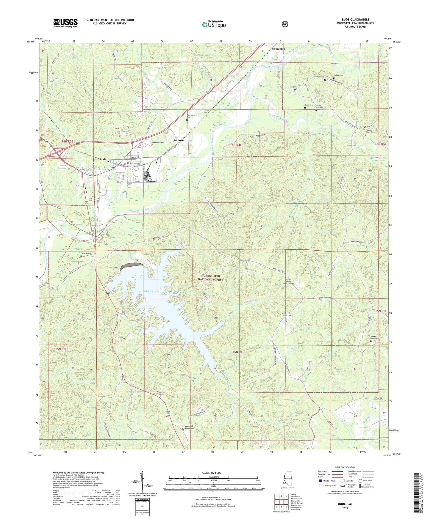
Bude Mississippi US Topo Map
Couldn't load pickup availability
Also explore the Bude Forest Service Topo of this same quad for updated USFS data
2024 topographic map quadrangle Bude in the state of Mississippi. Scale: 1:24000. Based on the newly updated USGS 7.5' US Topo map series, this map is in the following counties: Franklin. The map contains contour data, water features, and other items you are used to seeing on USGS maps, but also has updated roads and other features. This is the next generation of topographic maps. Printed on high-quality waterproof paper with UV fade-resistant inks.
Quads adjacent to this one:
West: Meadville
Northwest: Kirby
North: Eddiceton
Northeast: McCall Creek
East: Little Springs
Southeast: Smithdale
South: Busy Corner
Southwest: Homochitto
This map covers the same area as the classic USGS quad with code o31090d7.
Contains the following named places: Bude, Bude District Ranger Station, Bude Lookout Tower, Bude Oil Field, Bude Police Department, Bude Post Office, Bude Sewage Lagoon Dam, Bude Volunteer Fire Department, Bude Work Center, Byrd Cemetery, Byrds Chapel, Byrds Chapel Cemetery, Cassedy Cemetery, Dick, Dixie Airport, Dry Creek, Franklin School, Hopewell Baptist Church, Hopewell Cemetery, Jeanes School, Ladds Branch, Lee Cemetery, McCall Creek, McDonald Cemetery, McGee Burnett Cemetery, McGehee Creek, Middleton Creek Cemetery, Middleton Creek Primitive Baptist Church, Monroe, Montgomery Cemetery, Moore Branch, Mount Zion Baptist Church, Mount Zion Cemetery, Mud Branch, Mulkey Cemetery, North Dry Creek, O Zion Baptist Church, Okhissa Lake, O'Zion Baptist Church Cemetery, Pilgrim Rest Cemetery, Pilgrim Rest Primitive Baptist Church, Pleasant Valley Baptist Church, Pleasant Valley Baptist Church Cemetery, Porter Creek, Rollins Creek, Schmidt Lake Dam, Scott Cemetery, Supervisor District 5, Town of Bude, Walker Cemetery, Willis Branch, Wolvington Branch, ZIP Codes: 39630, 39653