
MyTopo
Cameron Mississippi US Topo Map
Couldn't load pickup availability
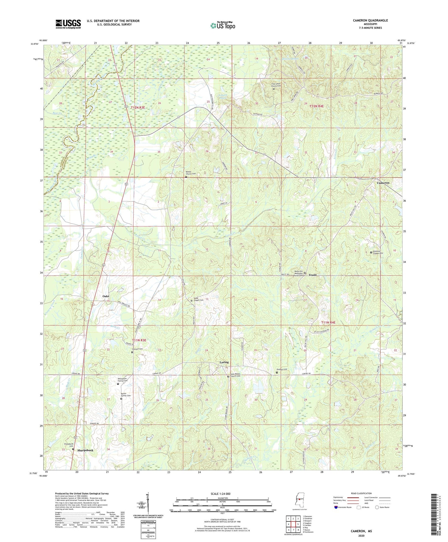
2020 topographic map quadrangle Cameron in the state of Mississippi. Scale: 1:24000. Based on the newly updated USGS 7.5' US Topo map series, this map is in the following counties: Madison, Yazoo. The map contains contour data, water features, and other items you are used to seeing on USGS maps, but also has updated roads and other features. This is the next generation of topographic maps. Printed on high-quality waterproof paper with UV fade-resistant inks.
Quads adjacent to this one:
West: Vaughan
Northwest: Ebenezer
North: Goodman
Northeast: Newport
East: Camden
Southeast: Farmhaven
South: Sharon
Southwest: Way
Contains the following named places: A B Mansell Lake Dam, Andrews Chapel, Andrews Chapel Cemetery, Bear Creek, Bethel Church, Bethel Church Cemetery, Bethel School, Blue Hole, C C Lord Lake Dam, Cameron, Concord Cemetery, Concord Church, Dickson Cemetery, E M Billingslea Lake Dam, Evening Star Church, Frank Cauthen Lake Dam, Free Union Church, Free Union Church Cemetery, H T Stubbs Lake Dam, Herrods Box, J H Fowler Lake Dam, J K Simpson Lake, J N Brown Lake Dam, Jack Lake, James Duncan Lake Dam, Joe Cauthen Lake Dam, Loring, Loves Creek, Martin Family Cemetery, Martin Presley Lake Dam, Mary Magdalene Church, Morning Star Church, Oaks, Pickens Oil Field, Rock Hill Church, Rocky Hill Methodist Church Cemetery, Saint Matthew Church, Saint Peter Church, Saint Peters Church Cemetery, Sharp Plantation, Sharpsburg, Sharpsburg Cemetery, Soule Chapel, Soule Chapel Cemetery, Spring Branch, Truitt, W S Billingslea Lake Dam, W S Billingsly Lake Dam, W W Billingsly Lake Dam, Williamson Family Cemetery


