MyTopo
Farmhaven Mississippi US Topo Map
Couldn't load pickup availability
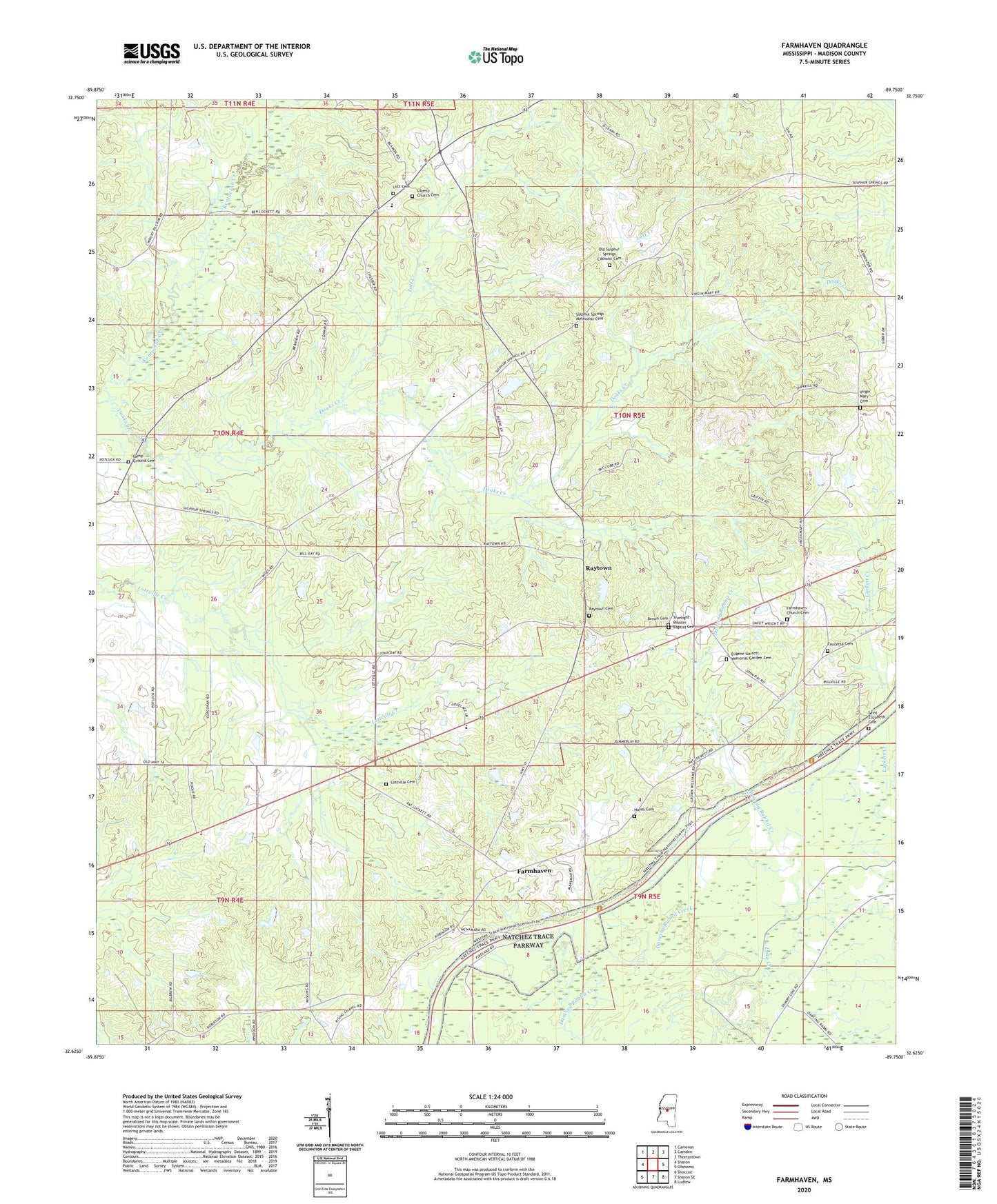
2024 topographic map quadrangle Farmhaven in the state of Mississippi. Scale: 1:24000. Based on the newly updated USGS 7.5' US Topo map series, this map is in the following counties: Madison. The map contains contour data, water features, and other items you are used to seeing on USGS maps, but also has updated roads and other features. This is the next generation of topographic maps. Printed on high-quality waterproof paper with UV fade-resistant inks.
Quads adjacent to this one:
West: Sharon
Northwest: Cameron
North: Camden
Northeast: Thomastown
East: Ofahoma
Southeast: Ludlow
South: Sharon SE
Southwest: Shoccoe
This map covers the same area as the classic USGS quad with code o32089f7.
Contains the following named places: Bennett Lake Dam, Brown Cemetery, Camp Ground Cemetery, Choctaw Boundary Historical Site, Clarks Chapel, Collin Wohner Lake Dam, Crossroads Church, Doaks Field, Doaks Mill, Doaks Stand, Doaks Stand Post Office, Eugene Garrett Memorial Garden Cemetery, Farmhaven, Farmhaven Church, Farmhaven Church Cemetery, Farmhaven Fire Station, Farmhaven School, Faucette Cemetery, Full Gospel Church, Havendale, Hayes Cemetery, Immaculate Conception Church, Kentuctah Creek, L L Bennett Pond Dam, Lee Chapel, Liberty Church, Liberty Church Cemetery, Lott Cemetery, Lott Creek, Lottville Cemetery, Lottville Church, Luckett Creek, Luther Branson Elementary School, Madison County Lake Dam, Millville, Mount Pilgrim Church, New Truelight Church, Old Sulphur Springs Catholic Cemetery, Old Truelight Church, Raytown, Raytown Cemetery, Rising Star Chapel, Rising Star School, Sacred Heart School, Saint Elizabeth Cemetery, Saint Elizabeth School, Sulpher Springs, Sulphur Springs Methodist Cemetery, Truelight Mission Baptist Cemetery, Virgin Mary Cemetery, Virgin Mary Church, Yockanookany Roadside Park