MyTopo
Charlton Mississippi US Topo Map
Couldn't load pickup availability
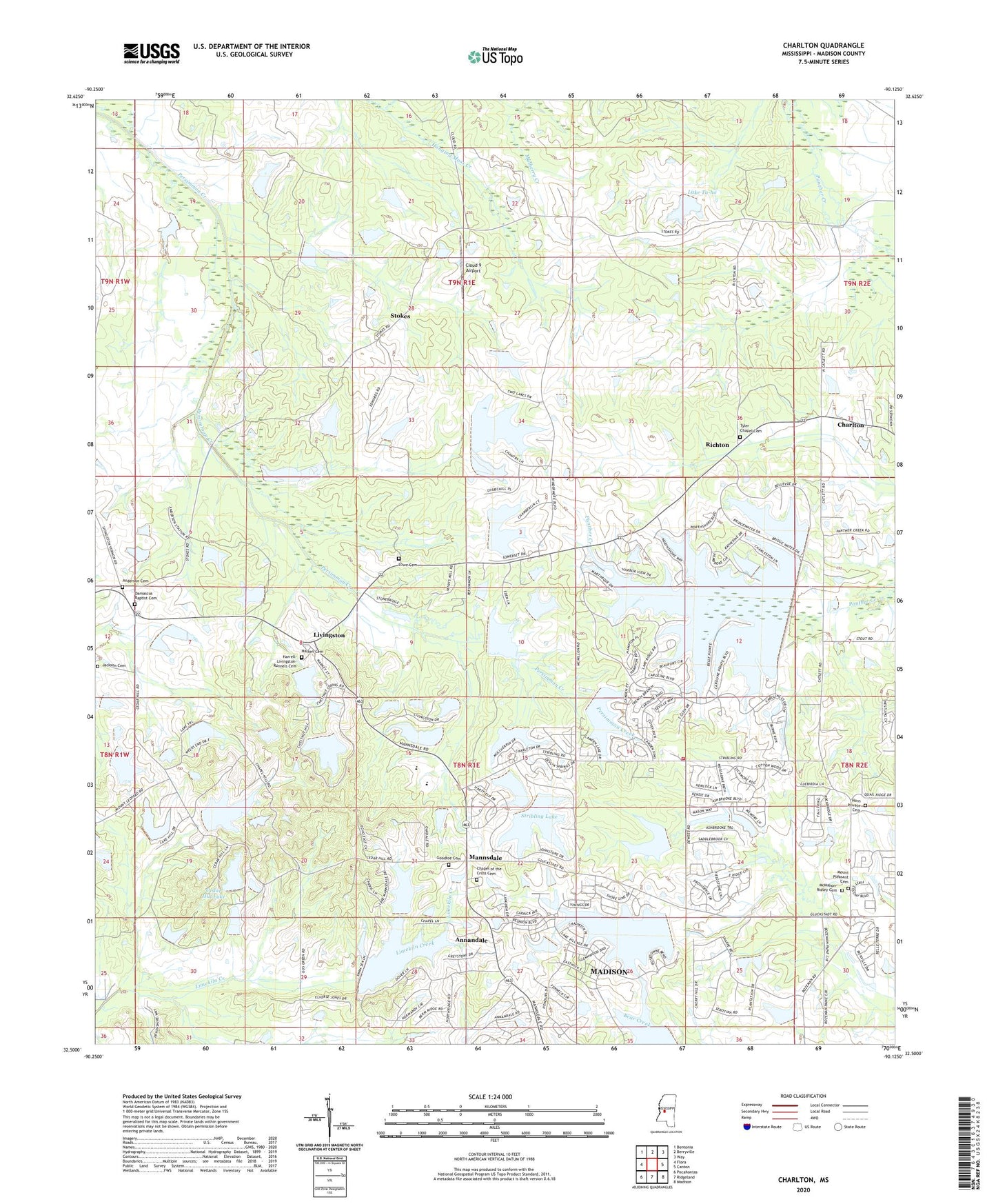
2020 topographic map quadrangle Charlton in the state of Mississippi. Scale: 1:24000. Based on the newly updated USGS 7.5' US Topo map series, this map is in the following counties: Madison. The map contains contour data, water features, and other items you are used to seeing on USGS maps, but also has updated roads and other features. This is the next generation of topographic maps. Printed on high-quality waterproof paper with UV fade-resistant inks.
Quads adjacent to this one:
West: Flora
Northwest: Bentonia
North: Berryville
Northeast: Way
East: Canton
Southeast: Madison
South: Ridgeland
Southwest: Pocahontas
Contains the following named places: Anderson, Anderson Cemetery, Annandale, Arbondale School, C L Hardaman Lake Dam, Cedar Hill Lake, Cedar Hill Lake Dam, Chapel of the Cross Cemetery, Charlton, Cloud 9 Airport, Damascus Baptist Cemetery, Damascus Church, G E Morgan Lake Dam, Goodloe Cemetery, Harrell-Livingston-Runnels Cemetery, Hatten Cemetery, Hopping Lake Dam, Horn Private Cemetery, J W Hartfield Lake Dam, Jackson Cemetery, Kendall Quinn Lake Dam, Lake Ta-ho, Livingston, Lowe Cemetery, Mannsdale, McMahon-Ridley Cemetery, Mount Pleasant Cemetery, Mount Pleasant Missionary Baptist Church, O J Andy Lake Dam, Persimmon-Burnt Corn Watershed Five Dam, R W Stribling Lake Dam, Richton, Stokes, Stone Plantation, Stribling Lake, Stribling Lake Dam, Supervisor District 2, Supervisor District 4, Tate Lake Dam, Tyler Chapel Cemetery, ZIP Code: 39110