MyTopo
Berryville Mississippi US Topo Map
Couldn't load pickup availability
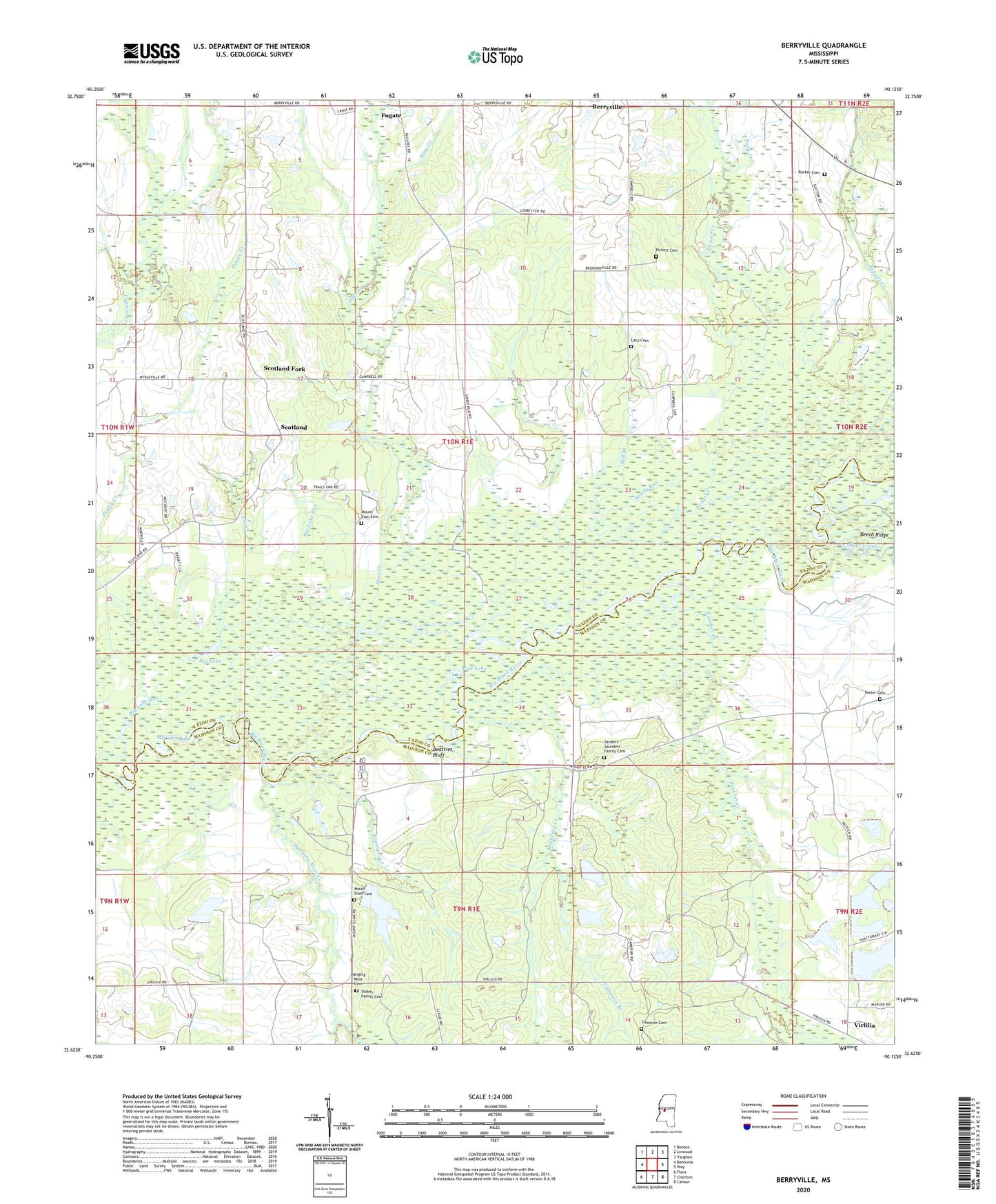
2024 topographic map quadrangle Berryville in the state of Mississippi. Scale: 1:24000. Based on the newly updated USGS 7.5' US Topo map series, this map is in the following counties: Yazoo, Madison. The map contains contour data, water features, and other items you are used to seeing on USGS maps, but also has updated roads and other features. This is the next generation of topographic maps. Printed on high-quality waterproof paper with UV fade-resistant inks.
Quads adjacent to this one:
West: Bentonia
Northwest: Benton
North: Linwood
Northeast: Vaughan
East: Way
Southeast: Canton
South: Charlton
Southwest: Flora
This map covers the same area as the classic USGS quad with code o32090f2.
Contains the following named places: Bear Creek, Beaties Bluff Post Office, Beatties Bluff, Beatties Branch, Bell Branch, Berryville, Bethlehem Church, Big Black Lake, Big Lake, Burg Creek, C G Thomas Lake Dam, Cameron Branch, Cameron Cemetery, Campbell Chapel, Cat Lake, Deadman Lake, Deer Creek, Fugate, Hanging Moss Cemetery, Hanging Moss Creek, Hendricks Lake, Hendricks Lake Run, Horseshoe Lake, Jay B Pepper Pond Dam, King Creek, Lacy Cemetery, McCann Lake, Mount Elam Cemetery, Mount Elam Church, Mount Hope Baptist Cemetery, Mount Hope Church, Mount Nebo Church, Mount Zion Cemetery, Mud Lake, Mulberry Creek, Panther Creek, Peggy Creek, Pepper Creek, Pepper Lake Dam, Pickett Cemetery, Pickett Creek, Pickett Lake, Pin Creek, Riddell Lake, Ross Lake, Rucker Cemetery, Rucker Creek, Sanders - Saunders Family Cemetery, Sandy Run, Scotland, Scotland Church, Scotland Fork, Stere Chapel, Stokes Family Cemetery, T Bar P Lake Dam, Teeter Cemetery, Union Church, Virlilia