MyTopo
Clark Mississippi US Topo Map
Couldn't load pickup availability
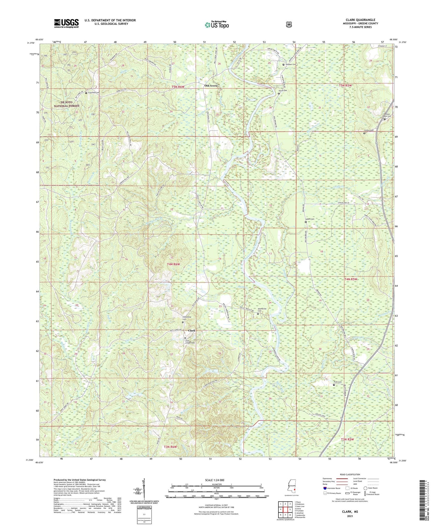
2021 topographic map quadrangle Clark in the state of Mississippi. Scale: 1:24000. Based on the newly updated USGS 7.5' US Topo map series, this map is in the following counties: Greene. The map contains contour data, water features, and other items you are used to seeing on USGS maps, but also has updated roads and other features. This is the next generation of topographic maps. Printed on high-quality waterproof paper with UV fade-resistant inks.
Quads adjacent to this one:
West: Avera
Northwest: Piave
North: Knobtown
Northeast: State Line
East: Fruitdale
Southeast: Rounsaville
South: Leakesville
Southwest: Jonathan
Contains the following named places: Adamsville, Adamsville Cemetery, Avera Cemetery, Big Branch, Brannon Creek, Byrd Creek, Church of Christ, Clark, Fellowship Cemetery, Fellowship Freewill Baptist Church, Flat Branch, Freefield Cemetery, Griffin Cemetery, Griffin Creek, Huff Branch, Johnson Creek, Johnson Creek Baptist Church, Johnson Creek Cemetery, McKinnis Creek, Morgan Mill Branch, Odom Cemetery, Old Avera, Painters Branch, Panther Branch, Platt Cemetery, Robertson Creek, Simpson Cemetery, Smith Creek, Supervisor District 2, Turkey Creek, Waterfork Branch