MyTopo
State Line Mississippi US Topo Map
Couldn't load pickup availability
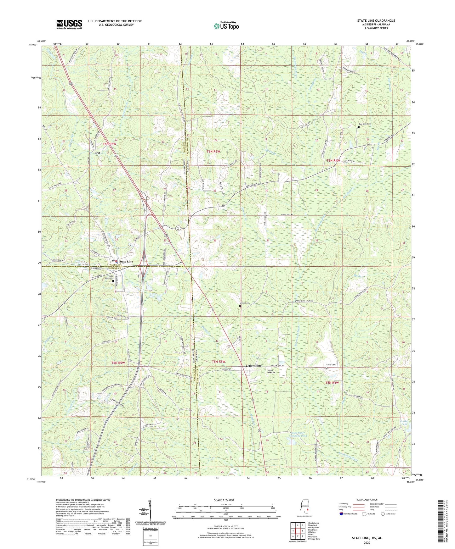
2024 topographic map quadrangle State Line in the states of Alabama, Mississippi. Scale: 1:24000. Based on the newly updated USGS 7.5' US Topo map series, this map is in the following counties: Greene, Washington, Wayne. The map contains contour data, water features, and other items you are used to seeing on USGS maps, but also has updated roads and other features. This is the next generation of topographic maps. Printed on high-quality waterproof paper with UV fade-resistant inks.
Quads adjacent to this one:
West: Knobtown
Northwest: Buckatunna
North: Copeland
Northeast: Millry South
East: Chatom
Southeast: Vinegar Bend
South: Fruitdale
Southwest: Clark
This map covers the same area as the classic USGS quad with code o31088d4.
Contains the following named places: Big Branch, Chatom Gas Field, Coaker Dam, Coaker Pond, Eret, First Baptist Church, Flat Branch, Gilley Cemetery, Givens Branch, Milstead Lookout Tower, Mount Moriah Church, Pine Log Branch, Red Bank Baptist Church, Red Bank Cemetery, Red Bank Creek, Savannah Branch, Sawmill Branch, Scott Paper Company Dam, Scott Paper Company Pond, Seven Oak Baptist Church, South Oak Grove Baptist Church, State Line, State Line Baptist Church, State Line Cemetery, State Line Police Department, State Line Post Office, State Line Volunteer Fire Department, Town of State Line, Union Baptist Church, Union Cemetery, Yellow Pine, Yellow Pine Baptist Church, Yellow Pine Cemetery, Yellow Pine Church of God