MyTopo
Rounsaville Mississippi US Topo Map
Couldn't load pickup availability
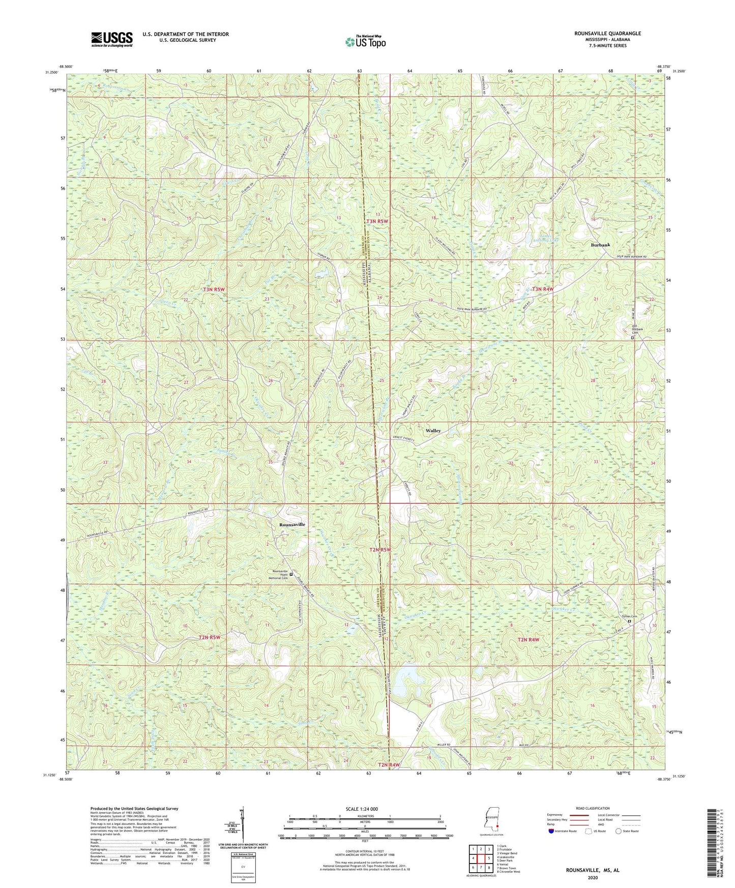
2024 topographic map quadrangle Rounsaville in the states of Mississippi, Alabama. Scale: 1:24000. Based on the newly updated USGS 7.5' US Topo map series, this map is in the following counties: Greene, Washington. The map contains contour data, water features, and other items you are used to seeing on USGS maps, but also has updated roads and other features. This is the next generation of topographic maps. Printed on high-quality waterproof paper with UV fade-resistant inks.
Quads adjacent to this one:
West: Leakesville
Northwest: Clark
North: Fruitdale
Northeast: Vinegar Bend
East: Deer Park
Southeast: Citronelle West
South: Brown Town
Southwest: Vernal
This map covers the same area as the classic USGS quad with code o31088b4.
Contains the following named places: Bethany Church, Boggy Branch, Burbank, Christmas Branch, Exsho, Gum Branch, Hurricane Branch, James Anthony Lake, Long Branch, Martins Swamp, Old Burbank Cemetery, Pat Branch, Pilgrims Rest Church, Rounsaville, Rounsaville Church, Rounsaville Hyatt Memorial Cemetery, Sand Creek, Spring Branch, Stalworth Camp, Turner Cemetery, Turners Store, Walley, ZIP Code: 36584