MyTopo
Avera Mississippi US Topo Map
Couldn't load pickup availability
Also explore the Avera Forest Service Topo of this same quad for updated USFS data
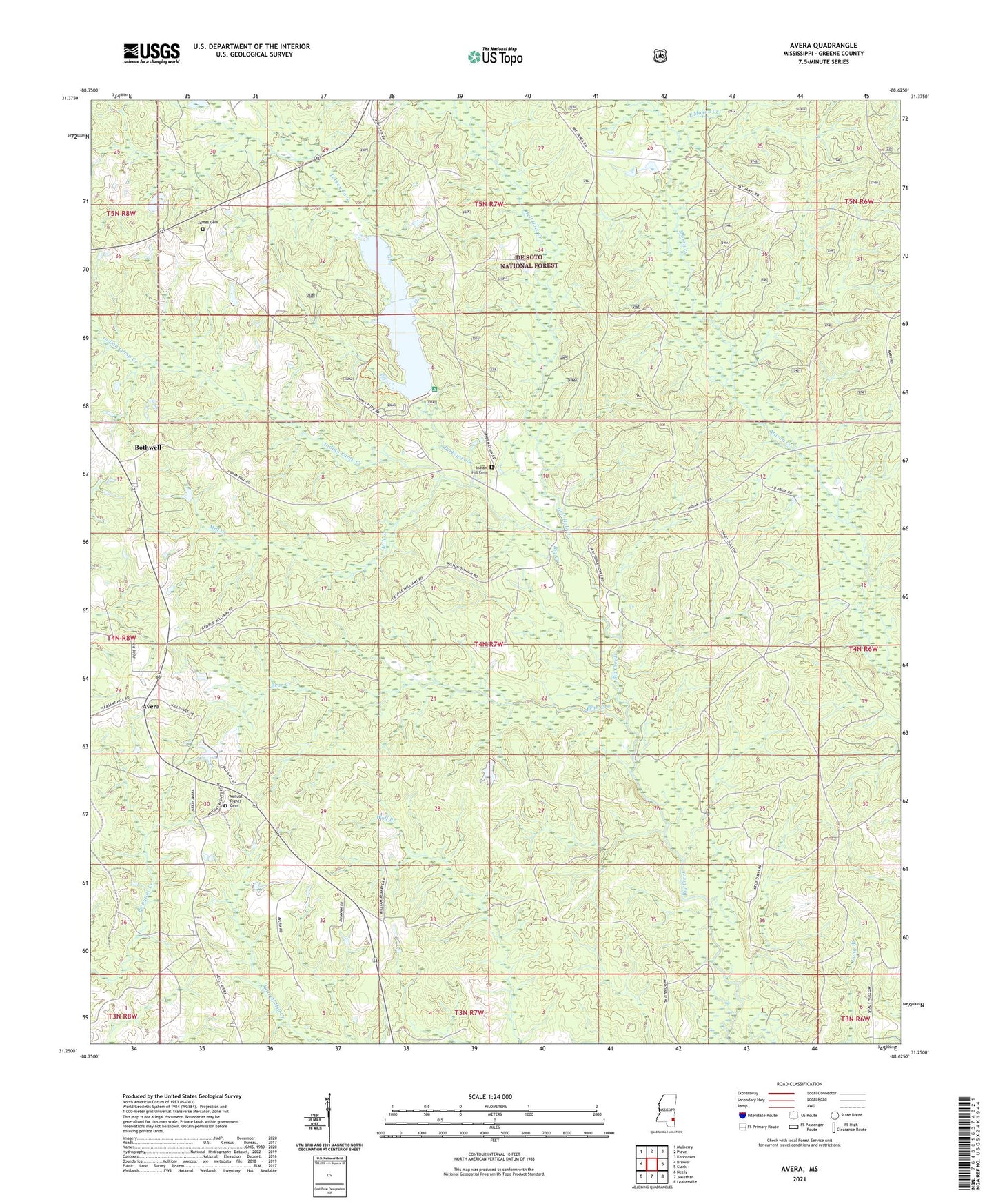
2024 topographic map quadrangle Avera in the state of Mississippi. Scale: 1:24000. Based on the newly updated USGS 7.5' US Topo map series, this map is in the following counties: Greene. The map contains contour data, water features, and other items you are used to seeing on USGS maps, but also has updated roads and other features. This is the next generation of topographic maps. Printed on high-quality waterproof paper with UV fade-resistant inks.
Quads adjacent to this one:
West: Brewer
Northwest: Mulberry
North: Piave
Northeast: Knobtown
East: Clark
Southeast: Leakesville
South: Jonathan
Southwest: Neely
This map covers the same area as the classic USGS quad with code o31088c6.
Contains the following named places: Avera, Bear Creek, Bothwell, Carson City, East Mason Creek, Hell Hole Creek, Indian Camp Creek, Indian Hill, Indian Hill Cemetery, Indian Hill School, James Cemetery, Kitrell Creek Reservoir Dam, Mill Creek, Mutual Rights Cemetery, Mutual Rights Church, Turkey Fork, Turkey Fork Recreation Site, Turkey Fork Reservoir, Turner Lake Dam