MyTopo
Coila Mississippi US Topo Map
Couldn't load pickup availability
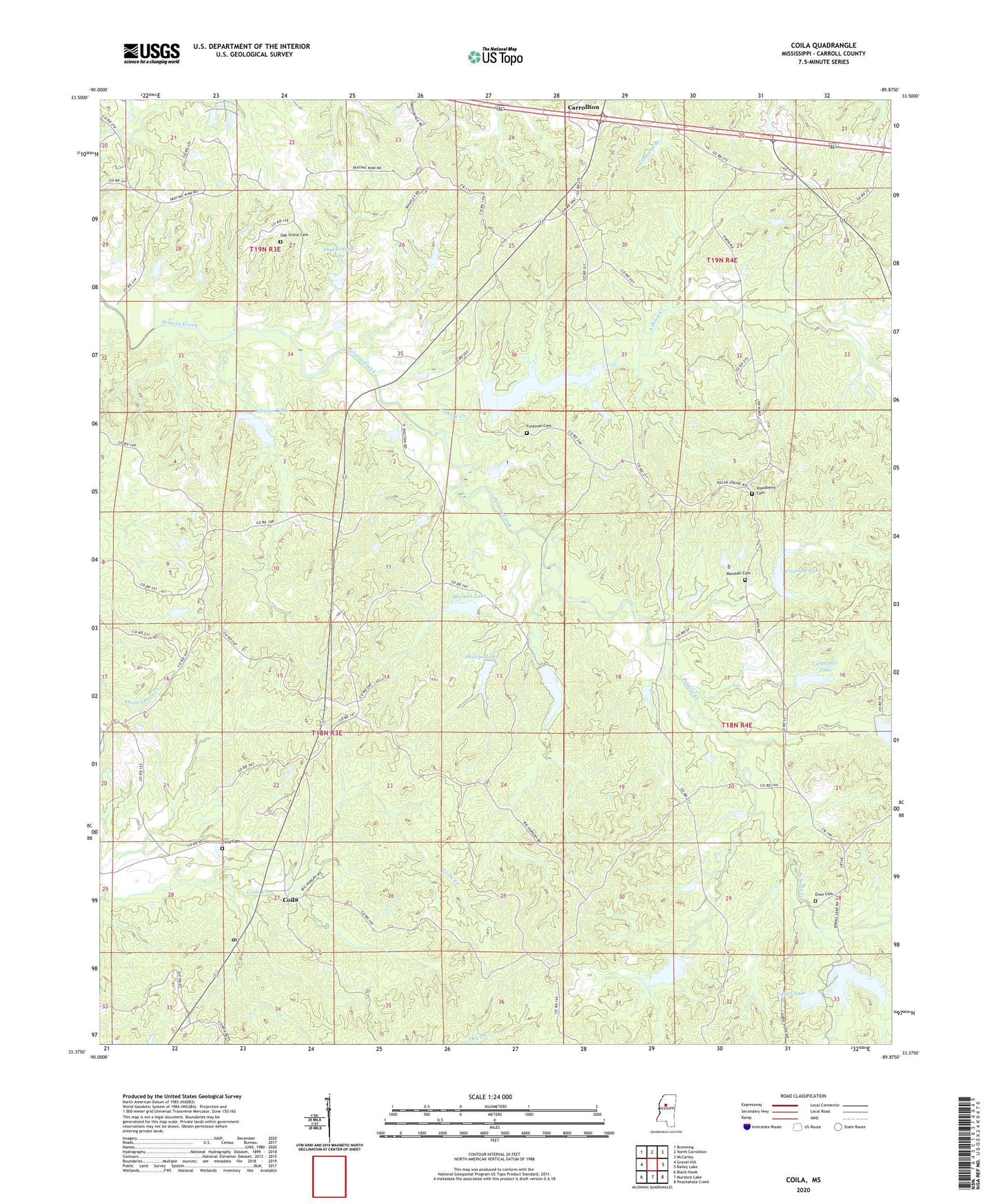
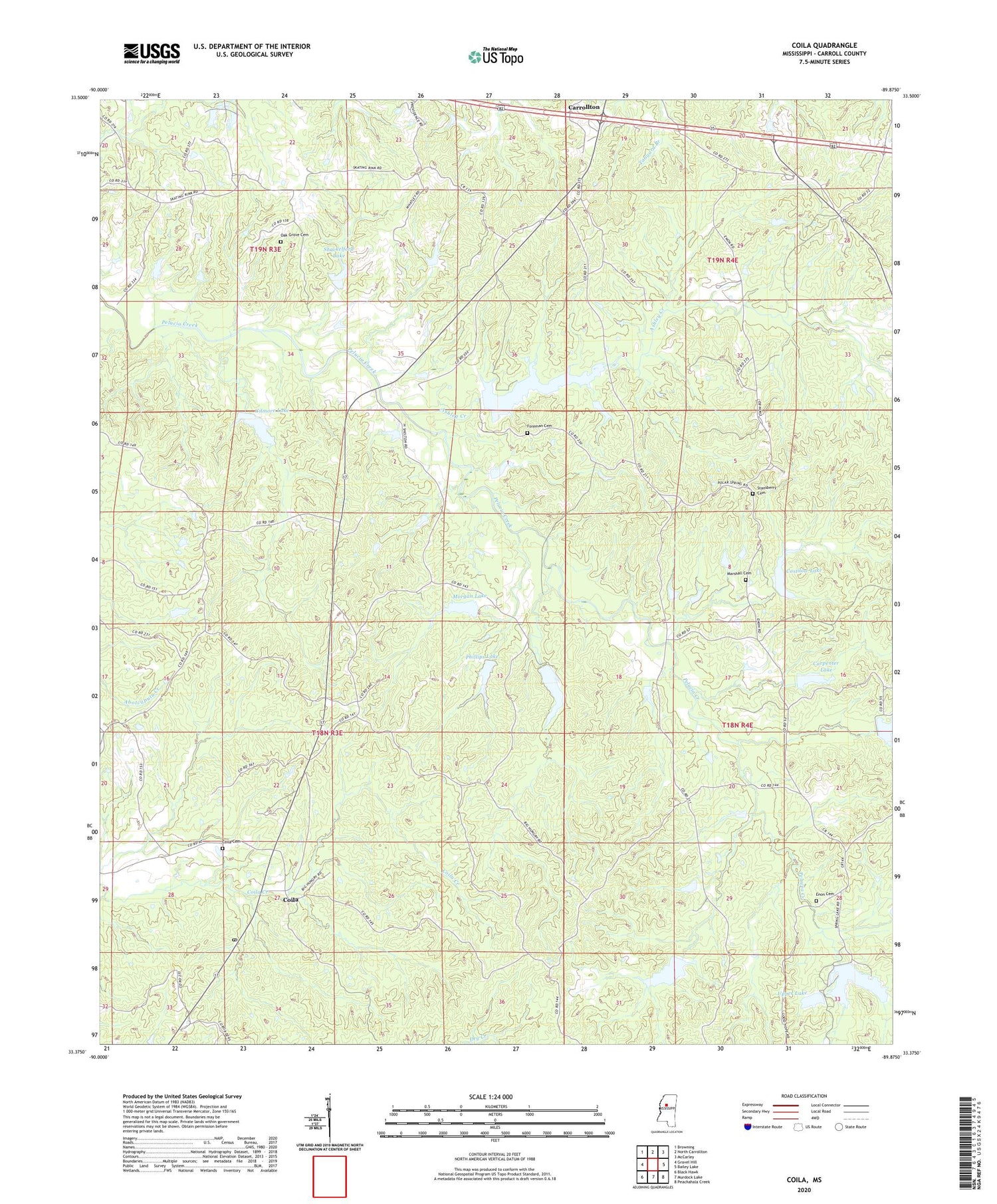
2020 topographic map quadrangle Coila in the state of Mississippi. Scale: 1:24000. Based on the newly updated USGS 7.5' US Topo map series, this map is in the following counties: Carroll. The map contains contour data, water features, and other items you are used to seeing on USGS maps, but also has updated roads and other features. This is the next generation of topographic maps. Printed on high-quality waterproof paper with UV fade-resistant inks.
Quads adjacent to this one:
West: Gravel Hill
Northwest: Browning
North: North Carrollton
Northeast: McCarley
East: Bailey Lake
Southeast: Peachahala Creek
South: Murdock Lake
Southwest: Black Hawk
Contains the following named places: Ashley Creek, Burkhead Lake, Carpenter Lake, Carroll County, Carrollton Lookout Tower, Coila, Coila Cemetery, Coila Post Office, Costilow Lake, Enon Cemetery, Enon Church, Foreman Cemetery, Gee Lake, Gilmore Lake, Marshall Cemetery, Morgan Lake, Oak Grove Cemetery, Pelucia Creek Structure Y-33a-26 Dam, Pelucia Creek Structure Y-33a-28 Dam, Pelucia Creek Structure Y-33a-39 Dam, Pelucia Watershed Y-33a-1 Dam, Pelucia Watershed Y-33a-10 Dam, Pelucia Watershed Y-33a-11 Dam, Pelucia Watershed Y-33a-12 Dam, Pelucia Watershed Y-33a-13 Dam, Pelucia Watershed Y-33a-2 Dam, Pelucia Watershed Y-33a-25a Dam, Pelucia Watershed Y-33a-3 Dam, Pelucia Watershed Y-33a-4 Dam, Pelucia Watershed Y-33a-6 Dam, Pelucia Watershed Y-33a-7 Dam, Pelucia Watershed Y-33a-8 Dam, Pelucia Watershed Y-33a-9 Dam, Phillips Lake, Poplar Springs Church, Shackelford Lake, Shelton Lake, Spring Lake, Springhill Church, Stansberry Cemetery, Upper Lake, ZIP Code: 38923