MyTopo
Bailey Lake Mississippi US Topo Map
Couldn't load pickup availability
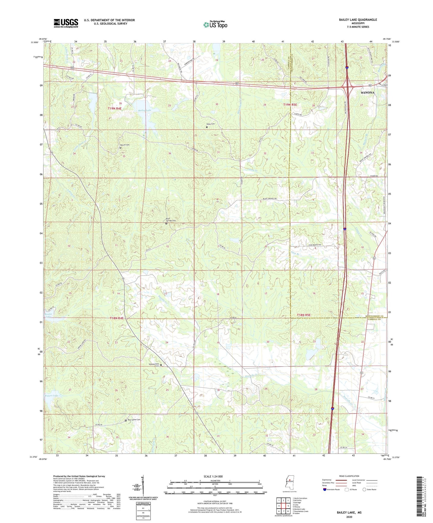
2024 topographic map quadrangle Bailey Lake in the state of Mississippi. Scale: 1:24000. Based on the newly updated USGS 7.5' US Topo map series, this map is in the following counties: Carroll, Montgomery. The map contains contour data, water features, and other items you are used to seeing on USGS maps, but also has updated roads and other features. This is the next generation of topographic maps. Printed on high-quality waterproof paper with UV fade-resistant inks.
Quads adjacent to this one:
West: Coila
Northwest: North Carrollton
North: McCarley
Northeast: Eskridge
East: Winona
Southeast: Vaiden
South: Peachahala Creek
Southwest: Murdock Lake
This map covers the same area as the classic USGS quad with code o33089d7.
Contains the following named places: Acorner Church, Bailey Lake, Big Sand Creek Watershed Y-32-9b Dam, Big Sand Watershed Y-32-9a Dam, Bluff Springs Cemetery, Bluff Springs Methodist Church, Booths Lake, Bryantville, Ebenezer Church, Friendship Church, G H Curtis Lake Dam, Hazel Green Church, Marvin Cemetery, Meadows Lake, Middleton, Nebo Cemetery, Nebo Church, New Salem Cemetery, New Salem Church, Pelucia Watershed Y-33a-5 Dam, Powells Creek, Saint Johns Chapel, Summerfield Cemetery, Summerfield Church, Supervisor District 4, Waters Lake