MyTopo
Conehatta Mississippi US Topo Map
Couldn't load pickup availability
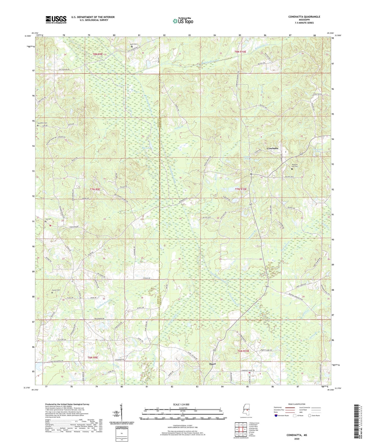
2024 topographic map quadrangle Conehatta in the state of Mississippi. Scale: 1:24000. Based on the newly updated USGS 7.5' US Topo map series, this map is in the following counties: Newton, Scott. The map contains contour data, water features, and other items you are used to seeing on USGS maps, but also has updated roads and other features. This is the next generation of topographic maps. Printed on high-quality waterproof paper with UV fade-resistant inks.
Quads adjacent to this one:
West: Harperville
Northwest: Walnut Grove
North: Sebastopol
Northeast: Union West
East: Decatur NW
Southeast: Newton
South: Lake
Southwest: Forest
This map covers the same area as the classic USGS quad with code o32089d3.
Contains the following named places: Amis Cemetery, B Hollingsworth Catfish Pond Dam, Big Lake, Bollybusha Creek, Box Creek, Brusha School, Caney Creek, Carson Pond, Charles McEdwards Catfish Pond Dam, Chestnut Springs School, Choctaw Church, Community Pond, Conehatta, Conehatta Census Designated Place, Conehatta Creek, Conehatta High School, Conehatta Missionary Baptist Church, Conehatta Post Office, Conehatta School, County Line School, Crooked Wood Creek, Crosby Mill, D Graham Lake Dam, Dennis Branch, Dorsey Branch, E J Pearson Lake Dam, Futchs Cemetery, Gibbstown - Lawrence Volunteer Fire Department, Goodhope Church, Goodhope School, Hazel, Hazel Church, Hensley Branch, James May Lake Dam, Lake School, Lake Volunteer Fire Department Station 2, Lay Cemetery, Macedonia Church, Mount Calvary Church, Mount Olive School, Mount Zion Church, Mount Zion School, Pearsons Catfish Pond Dam, Pearsons Mill, Piketown, Pleasant Hill Cemetery, Pleasant Ridge Church, Saint Catherine Church, Salem Church, Sellers Creek, Sharon Church, Summers Cemetery, Warrior Canal, Warrior Creek, Wolf Branch, ZIP Code: 39057