MyTopo
Lake Mississippi US Topo Map
Couldn't load pickup availability
Also explore the Lake Forest Service Topo of this same quad for updated USFS data
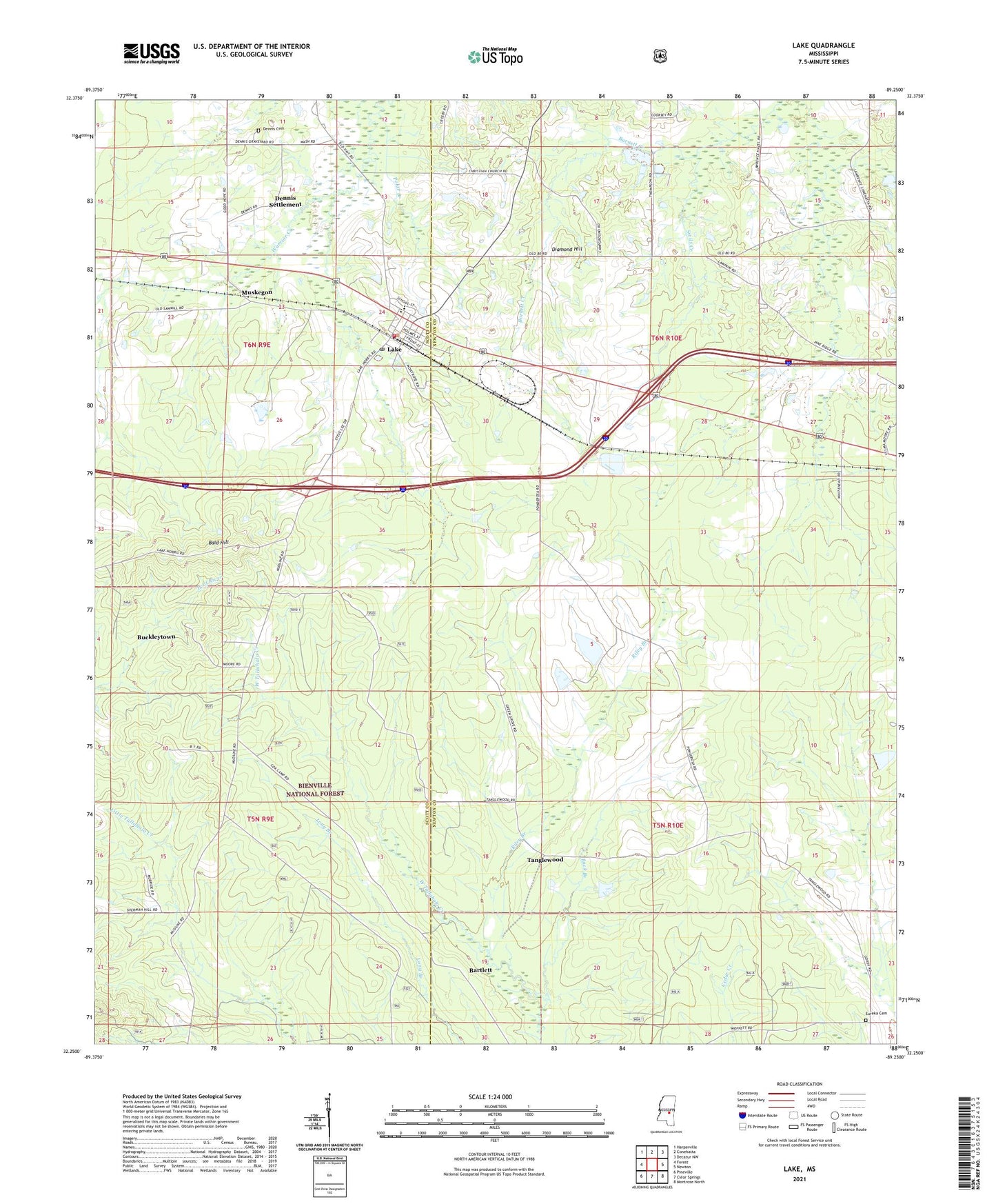
2024 topographic map quadrangle Lake in the state of Mississippi. Scale: 1:24000. Based on the newly updated USGS 7.5' US Topo map series, this map is in the following counties: Newton, Scott. The map contains contour data, water features, and other items you are used to seeing on USGS maps, but also has updated roads and other features. This is the next generation of topographic maps. Printed on high-quality waterproof paper with UV fade-resistant inks.
Quads adjacent to this one:
West: Forest
Northwest: Harperville
North: Conehatta
Northeast: Decatur NW
East: Newton
Southeast: Montrose North
South: Clear Springs
Southwest: Pineville
This map covers the same area as the classic USGS quad with code o32089c3.
Contains the following named places: Bald Hill, Ball Hill, Barnett Creek, Bartlett, Buck Branch, Buckleytown, Dennis Cemetery, Dennis Settlement, Diamond Hill, Earl Davis Pond Dam, Eureka Cemetery, Eureka Church, First Baptist Church, Green Grove Church, Green Grove School, Lake, Lake Attendance Center, Lake Church, Lake Elementary School, Lake Holiness Church, Lake Post Office, Little Italy, Muskegon, Patrons Union, Patrons Union Campground, Pine Ridge Church, Pine Ridge School, Polar Branch, Riley Branch, Rush School, Saint Mark Church, Sand Ridge Church, Sivils Creek, Stovall Lake Dam, Tallahala School, Tanglewood, Town of Lake, ZIP Codes: 39092, 39336