MyTopo
Crenshaw South Mississippi US Topo Map
Couldn't load pickup availability
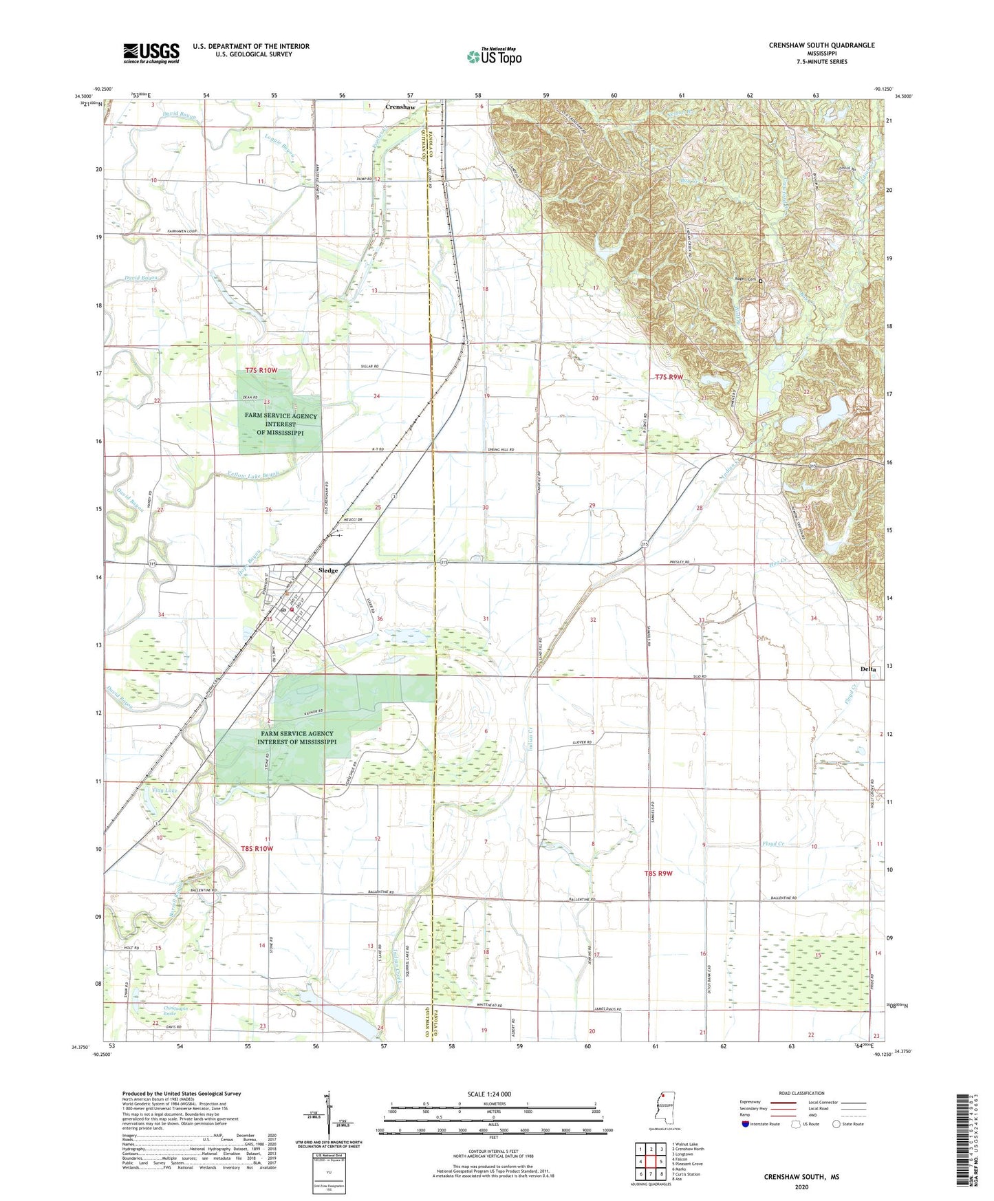
2020 topographic map quadrangle Crenshaw South in the state of Mississippi. Scale: 1:24000. Based on the newly updated USGS 7.5' US Topo map series, this map is in the following counties: Panola, Quitman. The map contains contour data, water features, and other items you are used to seeing on USGS maps, but also has updated roads and other features. This is the next generation of topographic maps. Printed on high-quality waterproof paper with UV fade-resistant inks.
Quads adjacent to this one:
West: Falcon
Northwest: Walnut Lake
North: Crenshaw North
Northeast: Longtown
East: Pleasant Grove
Southeast: Asa
South: Curtis Station
Southwest: Marks
Contains the following named places: Bay Creek, Bethel Church, Chinquapin Brake, Corn Lake, Crawford Creek, David Bayou, Delta, Easley Church, Fairhaven Church, Fairview Church, First Baptist Church of Sledge, Flag Lake, Floyd Creek, Fowler Creek, Hog Creek, Hope Bayou, Indian Creek, Indian Creek Watershed Y-9a-14 Dam, Indian Creek Watershed Y-9a-15 Dam, Jacks Lake, James Church, Johnson Church, Loggie Bayou, Mastodon, Mastodon School, Mickens Chapel, Mount Olive Church, Mount Zion Church, Mud Lake Church, Peach Creek, Pecan Bayou, Pecan Lake, Phillips Chapel, Pilgrims Rest Church, Pilgrims Rest School, Pleasant Grove Church, Pruit Lake, Rogers Cemetery, Saint John Church, Saint Joseph Church, Saint Paul Church, Sledge, Sledge Elementary School, Sledge High School, Sledge Post Office, Sledge Volunteer Fire Department, Springhill Church, Town of Sledge, Union Grove Church, White Oak, White Oak Church, White Oak School, Wolf Branch, Yellow Lake, Yellow Lake Bayou, ZIP Code: 38621