MyTopo
Walnut Lake Mississippi US Topo Map
Couldn't load pickup availability
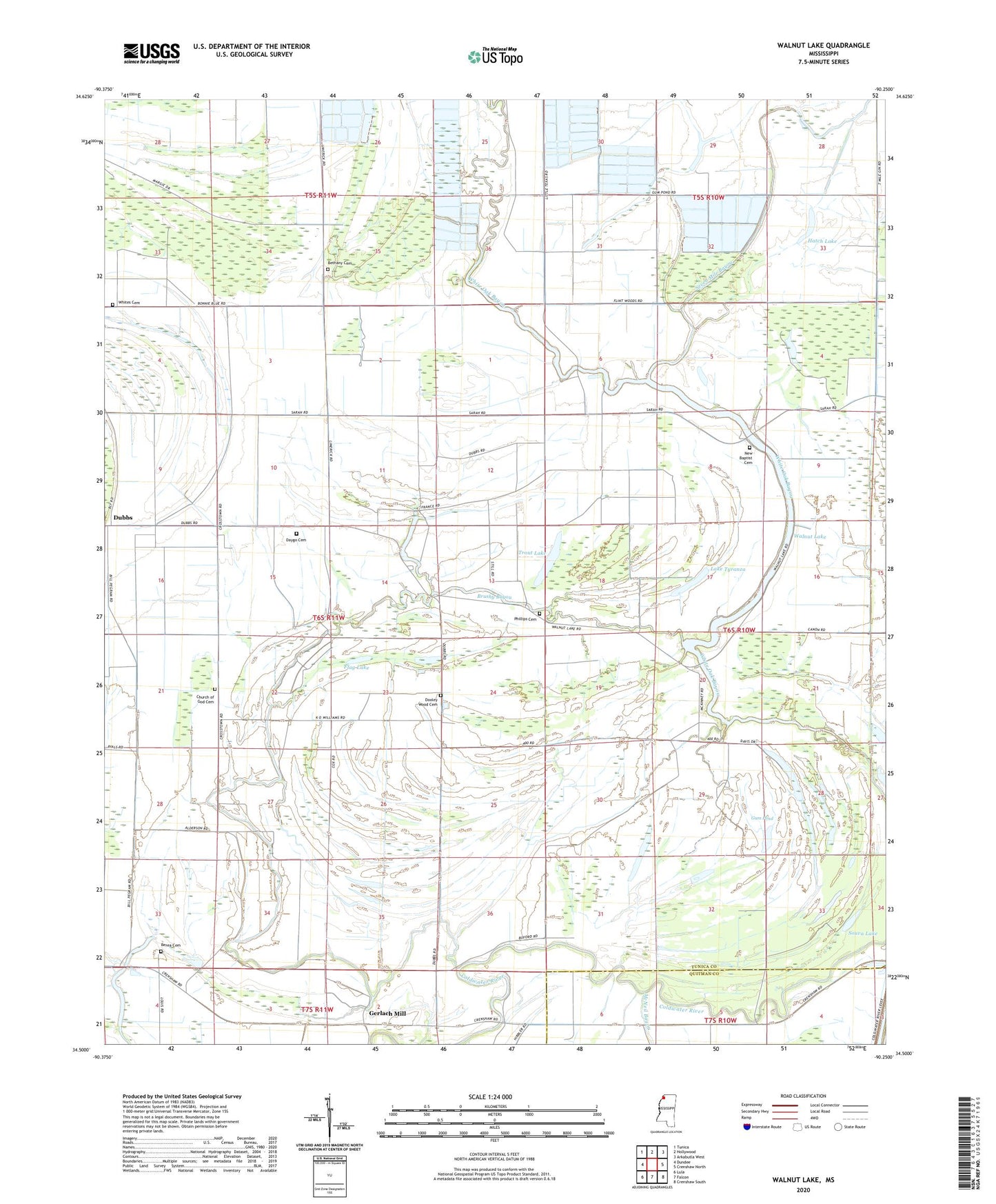
2024 topographic map quadrangle Walnut Lake in the state of Mississippi. Scale: 1:24000. Based on the newly updated USGS 7.5' US Topo map series, this map is in the following counties: Tunica, Quitman. The map contains contour data, water features, and other items you are used to seeing on USGS maps, but also has updated roads and other features. This is the next generation of topographic maps. Printed on high-quality waterproof paper with UV fade-resistant inks.
Quads adjacent to this one:
West: Dundee
Northwest: Tunica
North: Hollywood
Northeast: Arkabutla West
East: Crenshaw North
Southeast: Crenshaw South
South: Falcon
Southwest: Lula
This map covers the same area as the classic USGS quad with code o34090e3.
Contains the following named places: Antioch Church, Berea Cemetery, Berea Church, Bethany Cemetery, Bethany Church, Bonnie Blue School, Brushy Bayou, Cannon School, Church of God Cemetery, Clear Lake, Daygo Cemetery, Dooley Wood Cemetery, Dooley Wood School, Dubbs, Dubbs School, East Dubbs Church, Flag Lake, Gerlach Mill, Gum Pond, Hally, Hatch Lake, Jehovan Rest Church, Lake Tyranza, Macedonia Church, McNeil Church, New Baptist Cemetery, New Baptist Church, Paul Battles Catfish Ponds Dam, Phillips Cemetery, Phillips Church, Pink, Pruett School, Seven Mile Bayou, Souva Lake, Thompson School, Trout Lake, Twomile Lake, Walnut Lake, White Oak Bayou, Whites Cemetery, Whites Church