MyTopo
Crosby Mississippi US Topo Map
Couldn't load pickup availability
Also explore the Crosby Forest Service Topo of this same quad for updated USFS data
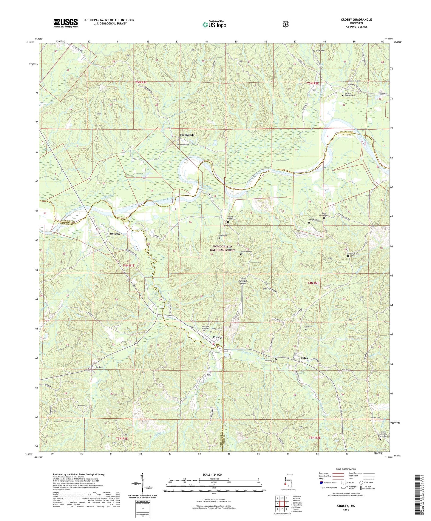
2024 topographic map quadrangle Crosby in the state of Mississippi. Scale: 1:24000. Based on the newly updated USGS 7.5' US Topo map series, this map is in the following counties: Amite, Franklin, Wilkinson. The map contains contour data, water features, and other items you are used to seeing on USGS maps, but also has updated roads and other features. This is the next generation of topographic maps. Printed on high-quality waterproof paper with UV fade-resistant inks.
Quads adjacent to this one:
West: Garden City
Northwest: Jeannette
North: Knoxville
Northeast: Meadville
East: Homochitto
Southeast: Bewelcome
South: Gloster
Southwest: Wilkinson
This map covers the same area as the classic USGS quad with code o31091c1.
Contains the following named places: Berryhill Cemetery, Bond Church, Brown Cemetery, Butler Cemetery, Campbellite Cemetery, Coles, Crosby, Crosby Attendance Center, Crosby Cemetery, Crosby Methodist Church, Crosby Municipal Airport, Crosby Police Department, Cypress Creek, Day Cemetery, Douglas Chapel, Dry Creek, Foster Creek, Freewoods, Freewoods Cemetery, Freewoods Oil Field, Hammack Cemetery, Harvard Ferry, Huff Cemetery, Lusk Cemetery, McDowell Cemetery, Mount Nebo Cemetery, Mount Nebo Church, Mount Nebo Lake, Mount Nebo Recreation Area, Nathaniel McDowell Cemetery, Nebo Lake Oil Field, North Freewoods Oil Field, Northeast Freewoods Oil Field, Oak Ridge Church, Parker Cemetery, Redding Creek, Richardson Creek, Rosetta, Royal Chapel, Royal Chapel Cemetery, Spring Hill Church, Spring Hill Oil Field, Stephenson, Stephenson Lookout Tower, Tar Creek, Town of Crosby, Union Church, Union Methodist Church Cemetery, Union School, Wesley Chapel, Wesley Chapel Cemetery, Wilk - Amite Volunteer Fire Department, Williams Cemetery, Wilsons Ferry, Zeigler Creek, Ziegler Creek Oil Field