MyTopo
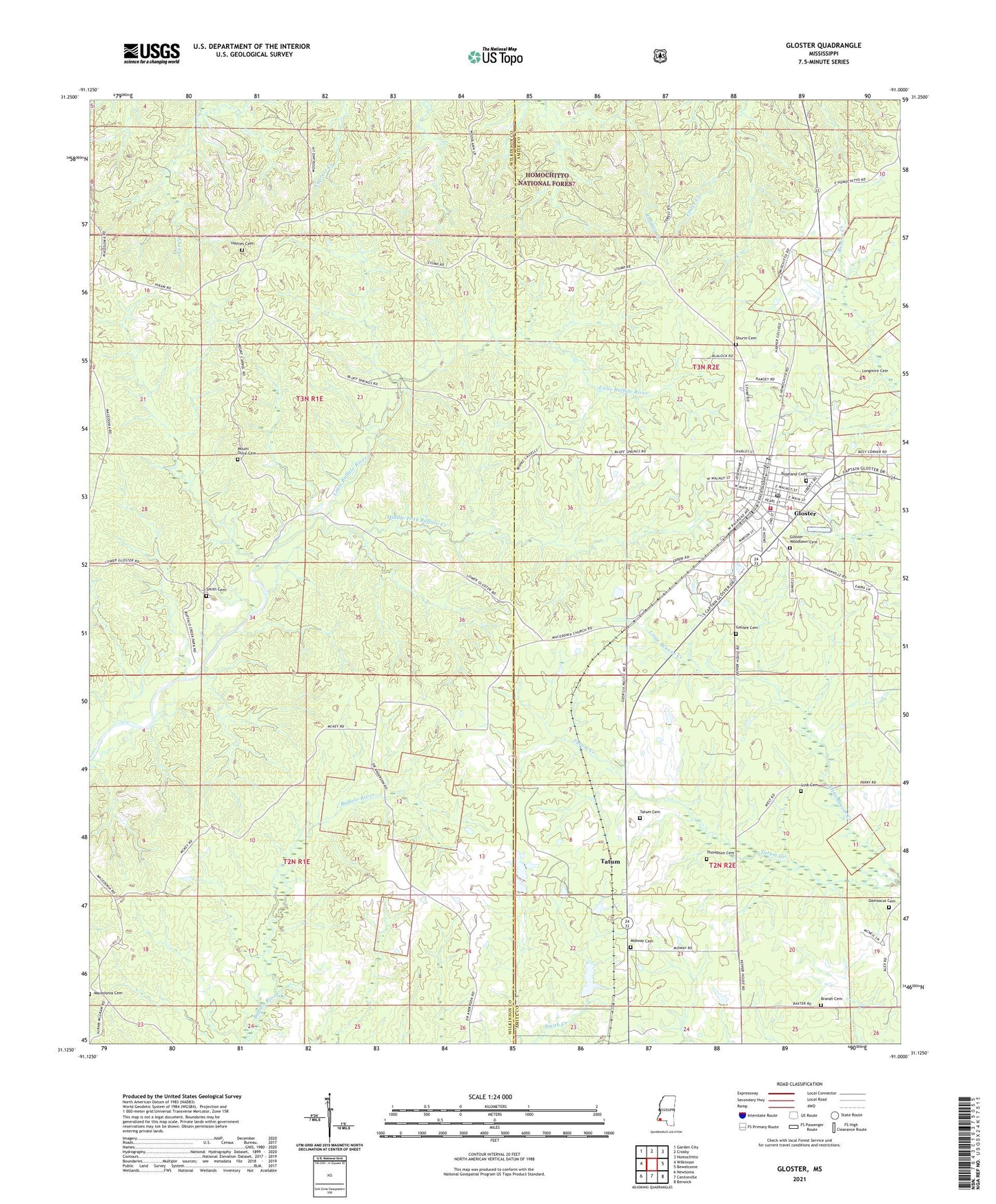
Gloster Mississippi US Topo Map
Couldn't load pickup availability
Also explore the Gloster Forest Service Topo of this same quad for updated USFS data
2024 topographic map quadrangle Gloster in the state of Mississippi. Scale: 1:24000. Based on the newly updated USGS 7.5' US Topo map series, this map is in the following counties: Wilkinson, Amite. The map contains contour data, water features, and other items you are used to seeing on USGS maps, but also has updated roads and other features. This is the next generation of topographic maps. Printed on high-quality waterproof paper with UV fade-resistant inks.
Quads adjacent to this one:
West: Wilkinson
Northwest: Garden City
North: Crosby
Northeast: Homochitto
East: Bewelcome
Southeast: Berwick
South: Centreville
Southwest: Newtonia
This map covers the same area as the classic USGS quad with code o31091b1.
Contains the following named places: Amite County Training School, Billings Chapel, Brandt Cemetery, Damascus Cemetery, Demasters Church, Enochs, Galilee Baptist Church, Galilee Cemetery, Gloster, Gloster Elementary School, Gloster First Baptist Church, Gloster High School, Gloster Police Department, Gloster Post Office, Gloster Rural Volunteer Fire Department, Gloster Woodlawn Cemetery, Griffin Junior Lake Dam, Hamochitto Work Center, Haynes Cemetery, Holy Family Catholic Church, Homochitto District Ranger Office, Longmire Cemetery, Lusk Cemetery, Lyons Lake Dam, Macedonia Cemetery, Macedonia Church, Middle Fork Buffalo creek, Midway Cemetery, Midway Church, Mount Carmel Church, Mount Olive Cemetery, Mount Olive Church, Pine Hills Academy, Raner, Roseland Cemetery, Sharron Chapel Christian Methodist Episcopal Church, Shurin Cemetery, Smith Cemetery, Tatum, Tatum Cemetery, Thompson Cemetery, Town of Gloster, Woodman Springs, Woodman Springs Picnic Area