MyTopo
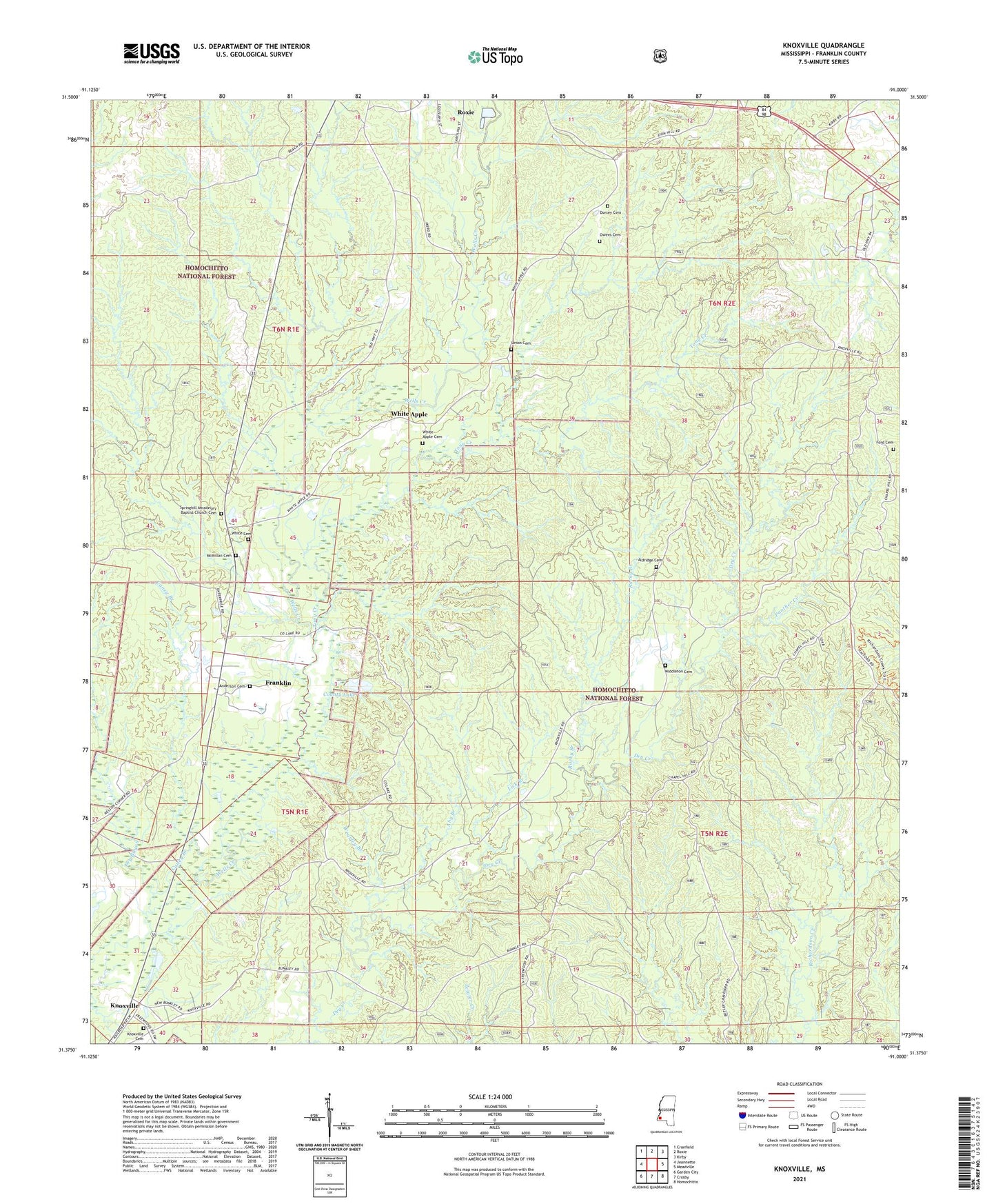
Knoxville Mississippi US Topo Map
Couldn't load pickup availability
Also explore the Knoxville Forest Service Topo of this same quad for updated USFS data
2024 topographic map quadrangle Knoxville in the state of Mississippi. Scale: 1:24000. Based on the newly updated USGS 7.5' US Topo map series, this map is in the following counties: Franklin. The map contains contour data, water features, and other items you are used to seeing on USGS maps, but also has updated roads and other features. This is the next generation of topographic maps. Printed on high-quality waterproof paper with UV fade-resistant inks.
Quads adjacent to this one:
West: Jeannette
Northwest: Cranfield
North: Roxie
Northeast: Kirby
East: Meadville
Southeast: Homochitto
South: Crosby
Southwest: Garden City
This map covers the same area as the classic USGS quad with code o31091d1.
Contains the following named places: Aby Branch, Aldridge Cemetery, Anderson Cemetery, Ashley Beaver Dam, Caney Branch, Clear Springs Oil Field, County Lake, County Lake Oil Field, Dorsey Cemetery, Dry Bayou, Dry Creek Oil Field, East County Lake Oil Field, East Franklin Oil Field, East Roxie Oil Field, Flat Rock, Flat Rock Oil Field, Ford Cemetery, Franklin, Franklin County Lake Dam, Franklin Oil Field, Knoxville, Knoxville Cemetery, Knoxville Methodist Church, Knoxville Oil Field, Knoxville Tower Oil Field, Lick Branch, Lowry Lake Oil Field, McMillan Cemetery, Middleton Cemetery, New Jerusalem Church, North Flat Rock Oil Field, North Freewood Oil Field, North Knoxville Oil Field, Owens Cemetery, Panther Creek, Panther Creek Oil Field, Richardson Creek Oil Field, Rocky Branch, Roxie Oil Field, South White Apple Oil Field, Springhill Church, Springhill Missionary Baptist Church Cemetery, Supervisor District 1, Tony Creek, Tubbyville, Union Baptist Church, Union Cemetery, Wearley Branch, Wesley Chapel Oil Field, White Apple, White Apple Cemetery, White Apple Oil Field, White Cemetery, Zion Church, ZIP Code: 39661