MyTopo
Dexter Mississippi US Topo Map
Couldn't load pickup availability
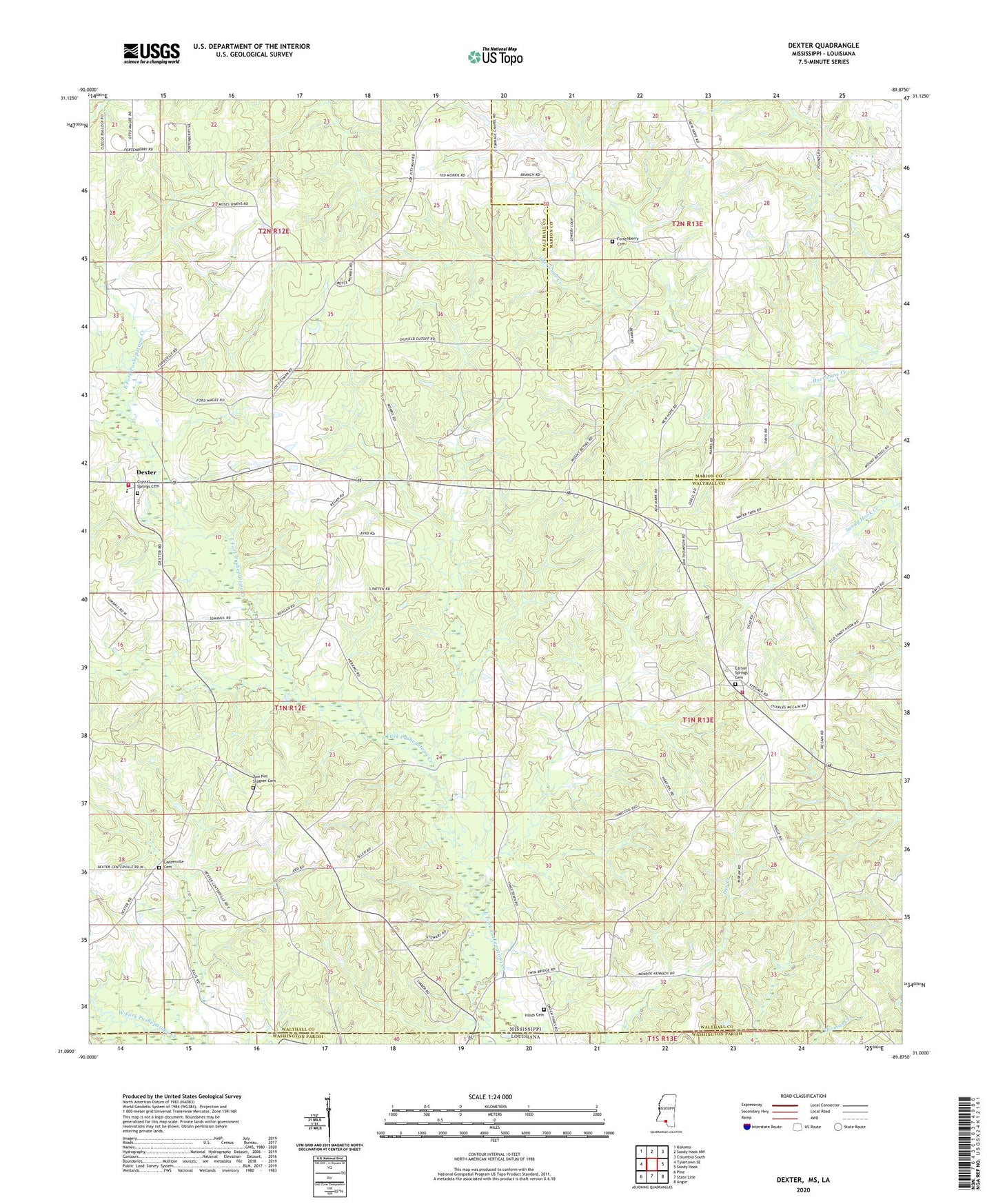
2024 topographic map quadrangle Dexter in the state of Mississippi. Scale: 1:24000. Based on the newly updated USGS 7.5' US Topo map series, this map is in the following counties: Walthall, Marion, Washington. The map contains contour data, water features, and other items you are used to seeing on USGS maps, but also has updated roads and other features. This is the next generation of topographic maps. Printed on high-quality waterproof paper with UV fade-resistant inks.
Quads adjacent to this one:
West: Tylertown SE
Northwest: Kokomo
North: Sandy Hook NW
Northeast: Columbia South
East: Sandy Hook
Southeast: Angie
South: State Line
Southwest: Pine
This map covers the same area as the classic USGS quad with code o31089a8.
Contains the following named places: Andersons Canal Structure Two Dam, Carson Springs Baptist Church, Carson Springs Cemetery, Centerville Cemetery, Centerville Church, Crystal Springs Baptist Church, Crystal Springs Cemetery, Dexter, Dexter Attendance Center, Dexter Oil and Gas Field, East Dexter Oil Field, East Mount Olive Baptist Church, Fortenberry Cemetery, Hinds Cemetery, Lowes Temple Church, Mount Bethel Church, Mount Bethel Number 2 Church, Supervisor District 3, Supervisor District 4, Tom Nat Stogner Cemetery, Walthall County Third District Fire Department Station 1, Walthall County Third District Fire Department Station 2