MyTopo
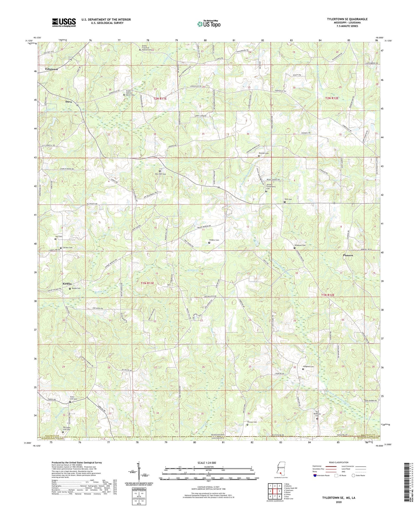
Tylertown SE Mississippi US Topo Map
Couldn't load pickup availability
2024 topographic map quadrangle Tylertown SE in the states of Mississippi, Louisiana. Scale: 1:24000. Based on the newly updated USGS 7.5' US Topo map series, this map is in the following counties: Walthall, Washington. The map contains contour data, water features, and other items you are used to seeing on USGS maps, but also has updated roads and other features. This is the next generation of topographic maps. Printed on high-quality waterproof paper with UV fade-resistant inks.
Quads adjacent to this one:
West: Tylertown
Northwest: Mesa
North: Kokomo
Northeast: Sandy Hook NW
East: Dexter
Southeast: State Line
South: Pine
Southwest: Clifton
This map covers the same area as the classic USGS quad with code o31090a1.
Contains the following named places: Alton Stogner Lake Dam, Ard Cemetery, Brandon Bay United Methodist Church, Calvary Baptist Church, Calvary Cemetery, Calvary Temple Pentecostal Church, Carto, Davo, Duncan Cemetery, Elisha Crawford Holmes Cemetery, Elisha Holmes Senior Cemetery, Flowers, Gospel Hall Church, Hobgood Cemetery, Jessie C Fortenberry Cemetery, Kirklin, Lees Chapel Baptist Church, Magee Hill Church, McKenzie Cemetery, Mount Moriah Baptist Church, New State Line Church, New Zion Baptist Church, New Zion Cemetery, Old State Line Cemetery, Oral Cemetery, Oral Church, Pittman Cemetery, Sam McKenzie Cemetery, State Line Cemetery, State Line United Pentecostal Church, Stogner Cemetery, Woods Cemetery