MyTopo
Double Springs Mississippi US Topo Map
Couldn't load pickup availability
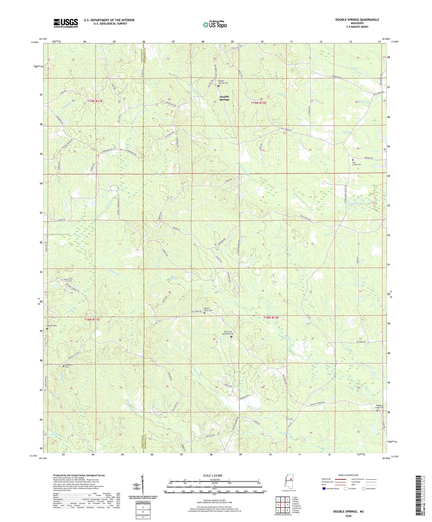
2024 topographic map quadrangle Double Springs in the state of Mississippi. Scale: 1:24000. Based on the newly updated USGS 7.5' US Topo map series, this map is in the following counties: Oktibbeha, Choctaw. The map contains contour data, water features, and other items you are used to seeing on USGS maps, but also has updated roads and other features. This is the next generation of topographic maps. Printed on high-quality waterproof paper with UV fade-resistant inks.
Quads adjacent to this one:
West: Reform
Northwest: Sapa
North: Maben
Northeast: Pheba
East: Longview
Southeast: Bradley
South: Sturgis
Southwest: Ackerman
This map covers the same area as the classic USGS quad with code o33089d1.
Contains the following named places: Bethlehem Church, Big Creek Methodist Cemetery, Big Creek Methodist Church, Busby School, Butler Lake Dam, Bywy Creek, Dido, Double Springs, Double Springs Baptist Church, Double Springs Cemetery, Double Springs Post Office, Dudley Branch, Faith Pentecostal Church of God, Furcher Branch, Glade Branch, High, Kleban Lake Dam, Lebanon, Lost Lake Dam, Maben Lookout Tower, McMinn Cemetery, McMinn Lake Dam, Mount Olive Cemetery, Pleasant Ridge, Pleasant Ridge Baptist Church, Pleasant Ridge Cemetery, Self Creek, Self Creek Bible Baptist Church, Self Creek Cemetery, Self Creek Christian Academy, Self Creek Southern Baptist Church, Spring Hill Cemetery, Springhill Church, Steadman School, Steelville