
MyTopo
Pheba Mississippi US Topo Map
Couldn't load pickup availability
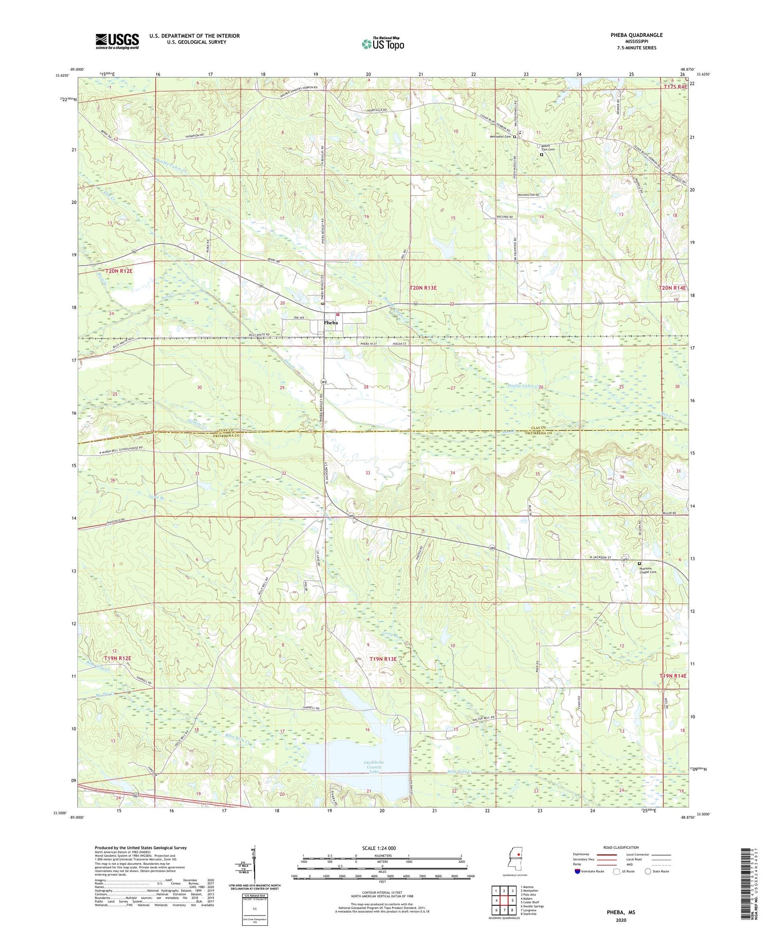
2024 topographic map quadrangle Pheba in the state of Mississippi. Scale: 1:24000. Based on the newly updated USGS 7.5' US Topo map series, this map is in the following counties: Oktibbeha, Clay. The map contains contour data, water features, and other items you are used to seeing on USGS maps, but also has updated roads and other features. This is the next generation of topographic maps. Printed on high-quality waterproof paper with UV fade-resistant inks.
Quads adjacent to this one:
West: Maben
Northwest: Mantee
North: Montpelier
Northeast: Palo Alto
East: Cedar Bluff
Southeast: Starkville
South: Longview
Southwest: Double Springs
This map covers the same area as the classic USGS quad with code o33088e8.
Contains the following named places: Bells, Bluff Creek, Bluff Creek Baptist Church, Bridges, By-Wy Creek, Clarks Mill, Clay County Volunteer Fire Department Unit 500 Pheba, Double Cabin Creek, Flat Creek, Foster Lake Dam, Hebron Baptist Church, Hebron School, Johnson Creek Church, Lakeside Estates, Long Branch, Lyon School, Methodist Cemetery, Mount Zion Cemetery, Mount Zion Church, New Bethel Baptist Church, Oktibbeha County Lake, Oktibbeha County Lake Dam, Pearsons Chapel, Pearsons Chapel Cemetery, Pheba, Pheba Census Designated Place, Pheba Post Office, Pleasant Hill Church, Robertson School, Robinson Missionary Baptist Church, Sixmile Creek, Strickland Lake Dam, Sudduth School, Supervisor District 3, Tampico, Vail Lake Dam, Waterfront Estates, ZIP Code: 39755


