MyTopo
Zeiglerville Mississippi US Topo Map
Couldn't load pickup availability
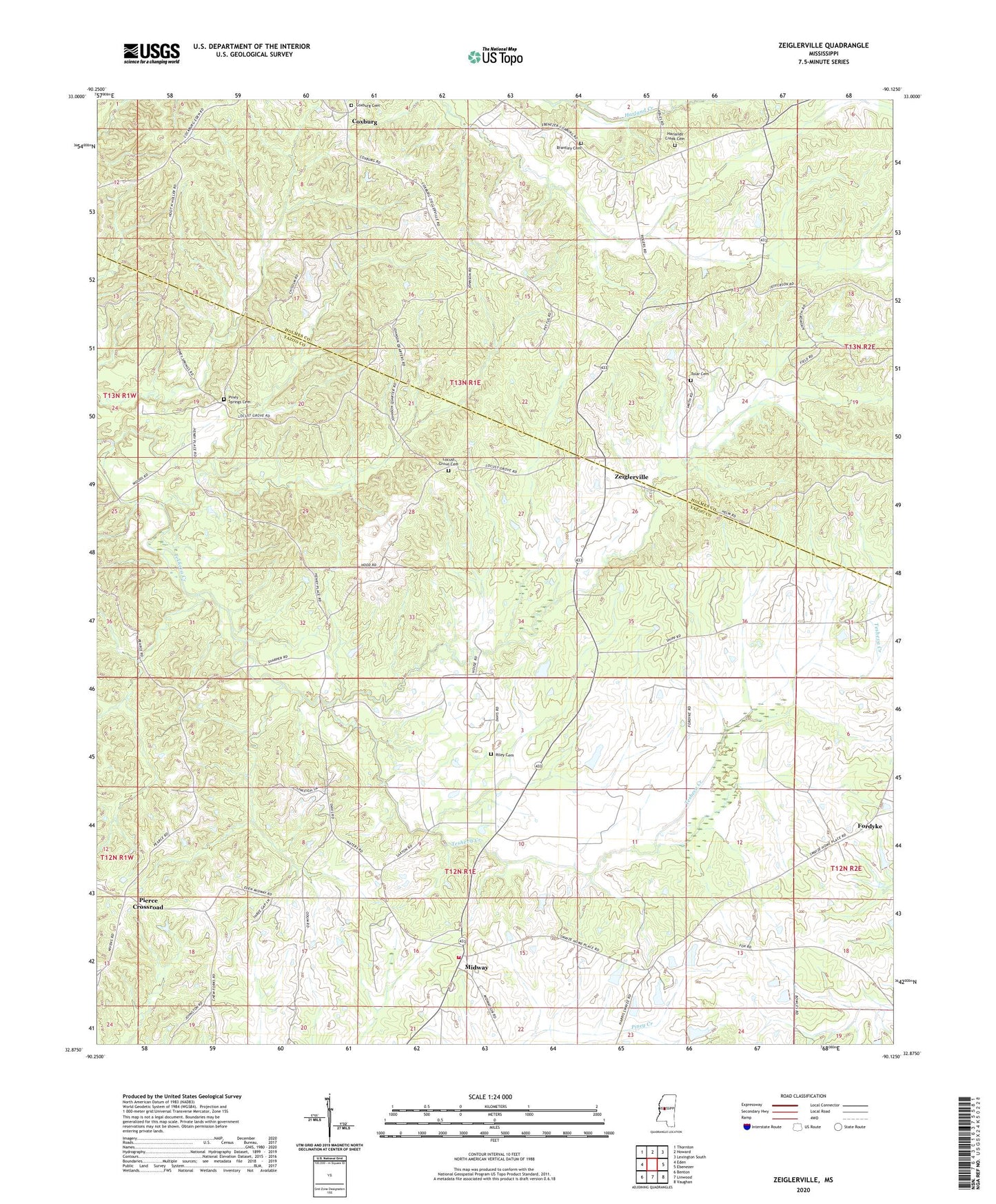
2024 topographic map quadrangle Zeiglerville in the state of Mississippi. Scale: 1:24000. Based on the newly updated USGS 7.5' US Topo map series, this map is in the following counties: Yazoo, Holmes. The map contains contour data, water features, and other items you are used to seeing on USGS maps, but also has updated roads and other features. This is the next generation of topographic maps. Printed on high-quality waterproof paper with UV fade-resistant inks.
Quads adjacent to this one:
West: Eden
Northwest: Thornton
North: Howard
Northeast: Lexington South
East: Ebenezer
Southeast: Vaughan
South: Linwood
Southwest: Benton
This map covers the same area as the classic USGS quad with code o32090h2.
Contains the following named places: Antioch Church, Brantley Cemetery, Coxburg, Coxburg Cemetery, Crossroads Church, Dula, Fordyke, Harland Creek Church, Harlands Creek Baptist Church Cemetery, King School, Locust Grove Cemetery, Macedonia Church, Midway, Midway Church, North Central Volunteer Fire Department, O Reilly Pond Dam, Pierce Crossroad, Piney Springs Baptist Church, Piney Springs Cemetery, Riley Cemetery, Saint Luke Church, Shiloh Church, Shipp Lake Dam, Swayze Lake Dam, Swayze Pond Dam, Tolar Cemetery, Water Grove Church, Zeiglerville