MyTopo
Eden Mississippi US Topo Map
Couldn't load pickup availability
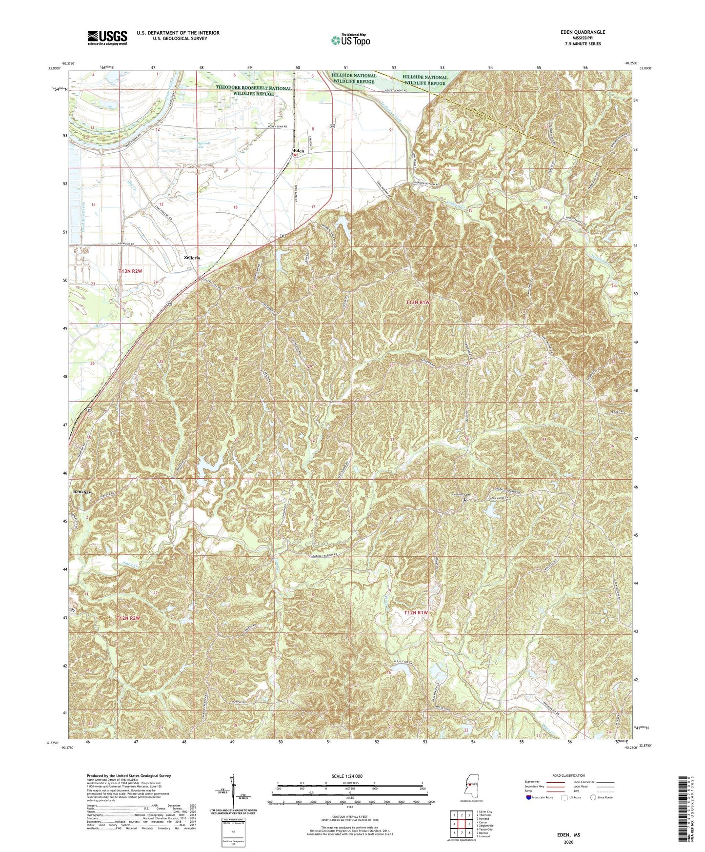
2020 topographic map quadrangle Eden in the state of Mississippi. Scale: 1:24000. Based on the newly updated USGS 7.5' US Topo map series, this map is in the following counties: Yazoo, Holmes. The map contains contour data, water features, and other items you are used to seeing on USGS maps, but also has updated roads and other features. This is the next generation of topographic maps. Printed on high-quality waterproof paper with UV fade-resistant inks.
Quads adjacent to this one:
West: Carter
Northwest: Silver City
North: Thornton
Northeast: Howard
East: Zeiglerville
Southeast: Linwood
South: Benton
Southwest: Yazoo City
Contains the following named places: Coleman Ponds Dam, Dead Man Bayou, Double Springs Church, Dover, Dover Landing, Eden, Eden Baptist Church, Eden Creek Watershed Number 10 Dam, Eden Creek Watershed Y-370-3 Dam, Eden Volunteer Fire Department, Fouche Lake Dam, Free Run, Hardshell Cemetery, Ingersoll Lake, Ingersols Landing, Johnston Lake Dam, Morning Star Church, New Foundation Church, Old Creek, Pearce, Piney Creek Watershed Structure 23 Dam, Piney Creek Watershed Y-38-3 Dam, Piney Creek Watershed Y-38-35 Dam, Piney Watershed Y-38-33 Dam, Pleasant Hill Church, Rocky Springs Church, Sheppards Landing, Strickland Lake Dam, Supervisor District 4, Tranquil Church, Van Land Landing, Village of Eden, Zelleria