MyTopo
Benton Mississippi US Topo Map
Couldn't load pickup availability
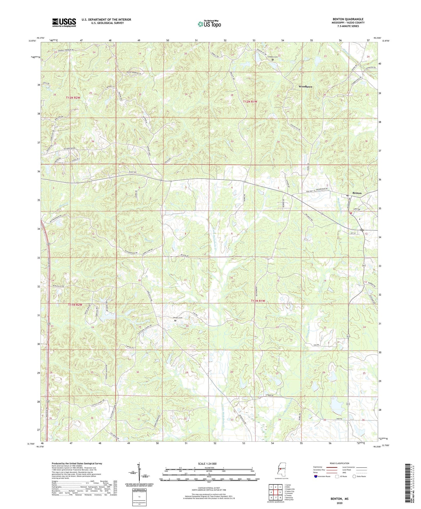
2024 topographic map quadrangle Benton in the state of Mississippi. Scale: 1:24000. Based on the newly updated USGS 7.5' US Topo map series, this map is in the following counties: Yazoo. The map contains contour data, water features, and other items you are used to seeing on USGS maps, but also has updated roads and other features. This is the next generation of topographic maps. Printed on high-quality waterproof paper with UV fade-resistant inks.
Quads adjacent to this one:
West: Yazoo City
Northwest: Carter
North: Eden
Northeast: Zeiglerville
East: Linwood
Southeast: Berryville
South: Bentonia
Southwest: Tinsley
This map covers the same area as the classic USGS quad with code o32090g3.
Contains the following named places: Anderson Catfish Pond Dam, Anderson Lake Dam, Bells Chapel, Benton, Benton Census Designated Place, Benton Post Office, Benton Volunteer Fire Department, Bethesda, Boylan Church, Captain Simmons Church, Castles Chapel, Cedar Hill, Coopers Cemetery, Edinburg High School, Fletchers Chapel, Forest Park Club Lake Dam, Fouche Lake Dam, Galilee Church, Hilton, Lear Lake Dam, McGraw Lake Dam, Peters Chapel Church, Piney Creek Watershed Y-38-26 Dam, Roadside, Saint Pauls Church, Silver Mountain Church, Silver Mountain School, Smith's Cemetery, Wesley Chapel, Williams Lake Dam, Woodlawn