MyTopo
Thornton Mississippi US Topo Map
Couldn't load pickup availability
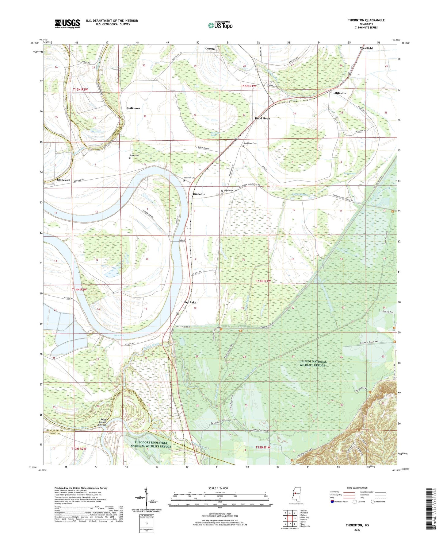
2024 topographic map quadrangle Thornton in the state of Mississippi. Scale: 1:24000. Based on the newly updated USGS 7.5' US Topo map series, this map is in the following counties: Holmes, Yazoo, Humphreys. The map contains contour data, water features, and other items you are used to seeing on USGS maps, but also has updated roads and other features. This is the next generation of topographic maps. Printed on high-quality waterproof paper with UV fade-resistant inks.
Quads adjacent to this one:
West: Silver City
Northwest: Belzoni
North: Marcella
Northeast: Tchula
East: Howard
Southeast: Zeiglerville
South: Eden
Southwest: Carter
This map covers the same area as the classic USGS quad with code o33090a3.
Contains the following named places: Arcola Landing, Bee Lake, Belle Prairie Cut-Off, Black Creek Ditch, Black Creek Landing, Bonanza Plantation, Brooks Cemetery, Chews Landing, Coopers Landing, Dunbarton Landing, Eagle Bank Landing, Fannegusha Ditch, Good Hope, Good Hope Cemetery, Good Hope Church, Good Hope School, Goodhope Landing, Hillside National Wildlife Refuge, Horseshoe Brake, Mileston, Mileston Elementary School, Mileston Landing, Old Black Creek, Omega, Omega Landing, Parker Bayou, Parkers Bayou Landing, Phoenix Landing, Pleasant Ridge Landing, Promised Land Church, Quafaloma Landing, Quofaloma, Quofaloma Church, Refuge Chapel, Stonewall, Stonewall Landing, Sweet Kingdom Church, Tesheva Creek, Thornton, Thornton Cemetery, Thornton Church, Tipton Bayou, Tipton Brake, Walnut Grove Church, Wylies Landing