MyTopo
Prairie Mississippi US Topo Map
Couldn't load pickup availability
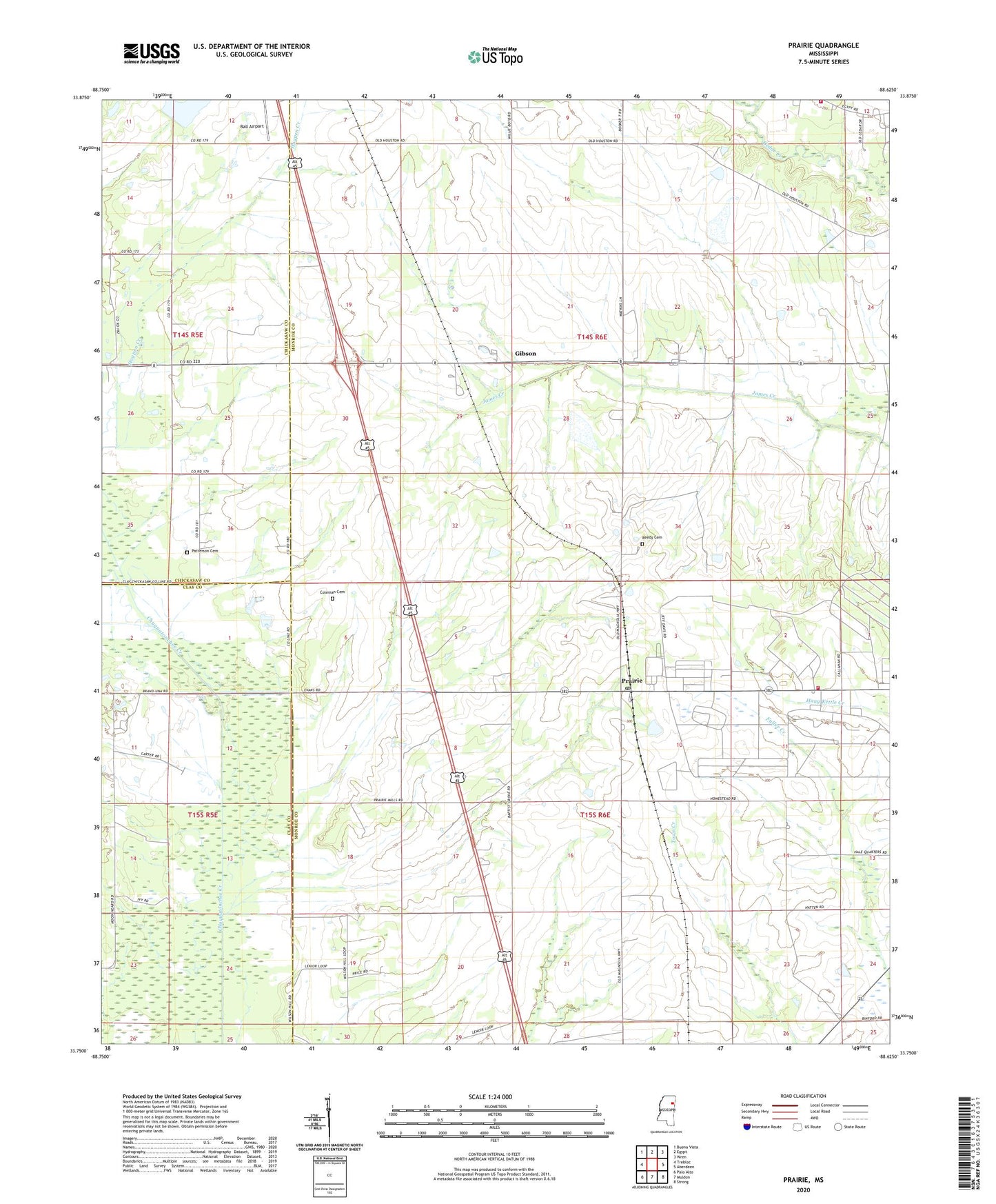
2024 topographic map quadrangle Prairie in the state of Mississippi. Scale: 1:24000. Based on the newly updated USGS 7.5' US Topo map series, this map is in the following counties: Monroe, Chickasaw, Clay. The map contains contour data, water features, and other items you are used to seeing on USGS maps, but also has updated roads and other features. This is the next generation of topographic maps. Printed on high-quality waterproof paper with UV fade-resistant inks.
Quads adjacent to this one:
West: Trebloc
Northwest: Buena Vista
North: Egypt
Northeast: Wren
East: Aberdeen
Southeast: Strong
South: Muldon
Southwest: Palo Alto
This map covers the same area as the classic USGS quad with code o33088g6.
Contains the following named places: Aberdeen-Prairie School, Ball Airport, Baptist Grove Missionary Baptist Church, Cedar Creek Volunteer Fire Department, Cedar Grove Baptist Church, Chuquatonchee Structure 19 Dam, Coleman Cemetery, Ebenezer Church, Friendship Church, Gibson, Gulf Ordnance Plant, Ingehosia Farms Lake Dam, Mount Nebo Community Center, Mount Nebo Missionary Baptist Church, Mount Union Missionary Baptist Church, Mount Zion Christian Church, New Hope Church, Patterson Cemetery, Prairie, Prairie Baptist Church, Prairie Methodist Church, Prairie Post Office, Prairie School, Prairie Volunteer Fire Department, Reedy Cemetery, Terrells, Zion Ridge Baptist Church, ZIP Code: 39756