MyTopo
Trebloc Mississippi US Topo Map
Couldn't load pickup availability
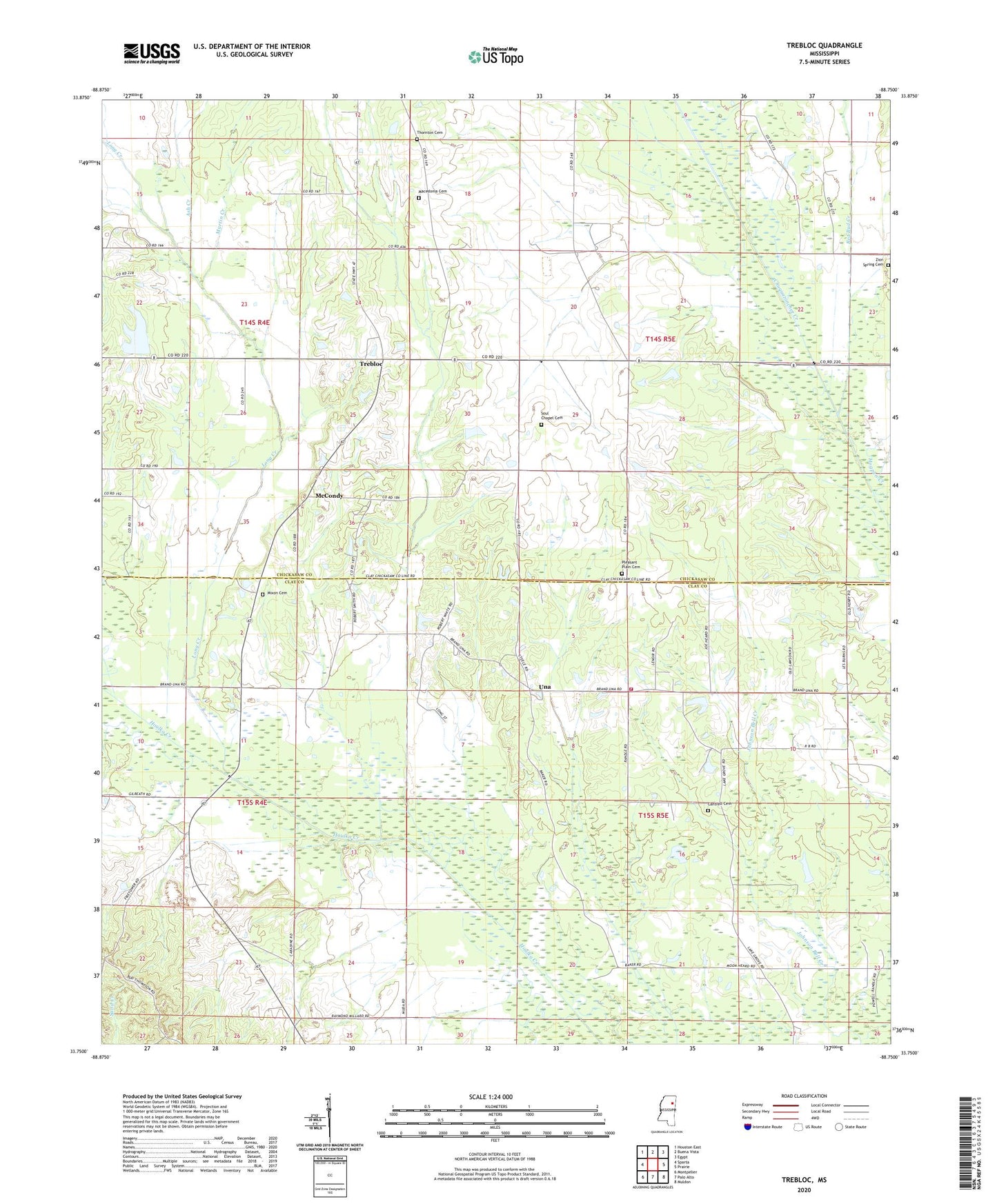
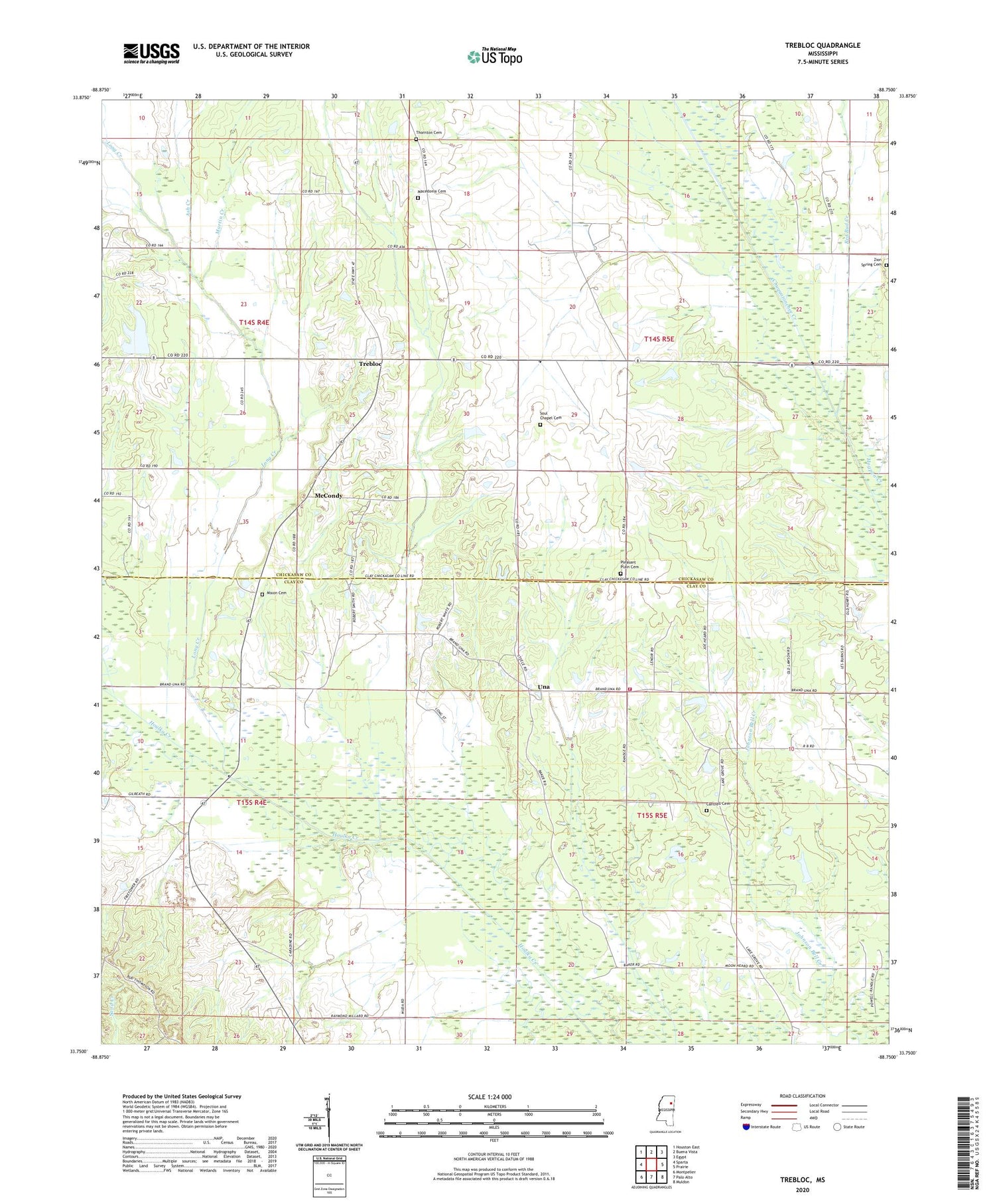
2024 topographic map quadrangle Trebloc in the state of Mississippi. Scale: 1:24000. Based on the newly updated USGS 7.5' US Topo map series, this map is in the following counties: Chickasaw, Clay. The map contains contour data, water features, and other items you are used to seeing on USGS maps, but also has updated roads and other features. This is the next generation of topographic maps. Printed on high-quality waterproof paper with UV fade-resistant inks.
Quads adjacent to this one:
West: Sparta
Northwest: Houston East
North: Buena Vista
Northeast: Egypt
East: Prairie
Southeast: Muldon
South: Palo Alto
Southwest: Montpelier
This map covers the same area as the classic USGS quad with code o33088g7.
Contains the following named places: Ash Creek, Barrs Mill, Bethlehem School, Bogue Culley, Cantrell Cemetery, Chickasaw Union Church, Clay County Volunteer Fire Department Unit 400, Ebenezer Methodist Church, Foster Chapel, Hogpen Creek, Lake Grove Church, Lake Grove School, Lawson Chapel, Long Creek, Macedonia, Macedonia Cemetery, Macedonia Missionary Baptist Church, Macedonia School, Macedonia United Methodist Church, Martin Creek, McCondy, McCondy Baptist Church, Miller Pond Dam, Mississippi No Name 140 Dam, Mixon Cemetery, Pleasant Grove Church, Pleasant Plain Baptist Church, Pleasant Plain Cemetery, Pleasant Plain School, Red Bud Creek, Shady Grove Baptist Church, Soul Chapel, Soul Chapel Cemetery, Thornton Cemetery, Trebloc, Trebloc Post Office, Una, Union Church, W J Linn Lake Dam, Wesley Chapel, Zion Spring Cemetery