MyTopo
Ellisville Mississippi US Topo Map
Couldn't load pickup availability
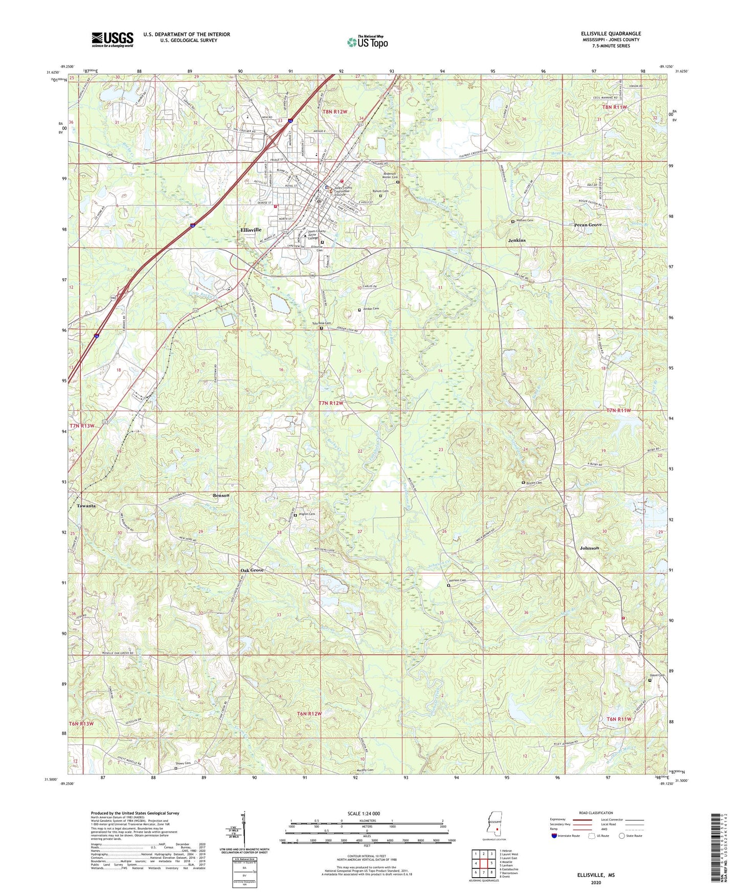
2024 topographic map quadrangle Ellisville in the state of Mississippi. Scale: 1:24000. Based on the newly updated USGS 7.5' US Topo map series, this map is in the following counties: Jones. The map contains contour data, water features, and other items you are used to seeing on USGS maps, but also has updated roads and other features. This is the next generation of topographic maps. Printed on high-quality waterproof paper with UV fade-resistant inks.
Quads adjacent to this one:
West: Moselle
Northwest: Hebron
North: Laurel West
Northeast: Laurel East
East: Lanham
Southeast: Ovett
South: Barrontown
Southwest: Eastabuchie
This map covers the same area as the classic USGS quad with code o31089e2.
Contains the following named places: Anderson - Minter Cemetery, Aplin Branch, Basie Branch, Bear Creek, Bear Creek School, Benson, Big Branch, Blackburn Crossing, Bradshaw School, Brown Cemetery, Buzzard Bay, Bynum Cemetery, Campus Lake Dam, City of Ellisville, Craft Lake Dam, Dacetown School, Doctor Bob Donald Catfish Ponds Dam, Donald Kitchens Lake Dam, Dry Branch, Ellisville, Ellisville Baptist Church, Ellisville Cemetery, Ellisville Elementary School, Ellisville Fire Department Station 1, Ellisville Fire Department Station 2, Ellisville First United Methodist Church, Ellisville Lagoon Dam, Ellisville Municipal Hospital, Ellisville Police Department, Ellisville Post Office, Ellisville State School, Ellisville State School Lake Dam, Elmore Pond Dam, Evertt Pond Dam, Fairfield Church, First Presbyterian Church of Ellisville, Friendship Baptist Church, Friendship School, Grindstone Branch, Harim Jordan Lake Dam, Hogpen Branch, Ike Farris Pond Dam, Jenkins, John Christian Lake Dam, John Christian Pond Dam, Johnson, Johnson Cemetery, Johnson Creek, Johnson School, Johnson Volunteer Fire Department, Jones County, Jones County Courthouse, Jones County Home, Jordan Cemetery, Jordan Lake, Little Rocky Creek, Magee Creek, McKinnon Mill, Mount Aide Church, New Hope Baptist Church, Oak Grove, Oak Grove Church, Odom Cemetery, Odom Mill, Ottis Robertson Lake Dam, Otto Wansley Lake Dam, Pecan Grove, Pecan Grove Baptist Church, Perry Fraser Mill, Pilgrim Cemetery, Pilgrim Primitive Baptist Church, Pleasant Grove Baptist Church, Pleasant Ridge Church, Rocky Creek, Roosevelt School, Salt Lake School, Sand Branch, Shows Cemetery, Simpson School, South Jones High School, Spring Hill Baptist Church, Supervisor District 4, Tallahoma Creek, Tawanta, Tawanta School, Tula Rosa Cemetery, Tula Rosa Church, Vardaman School, W I Kitchens Lake Dam, Walters Cemetery, West Ellisville Baptist Church, WNSL-FM (Laurel), ZIP Code: 39437