MyTopo
Falcon Mississippi US Topo Map
Couldn't load pickup availability
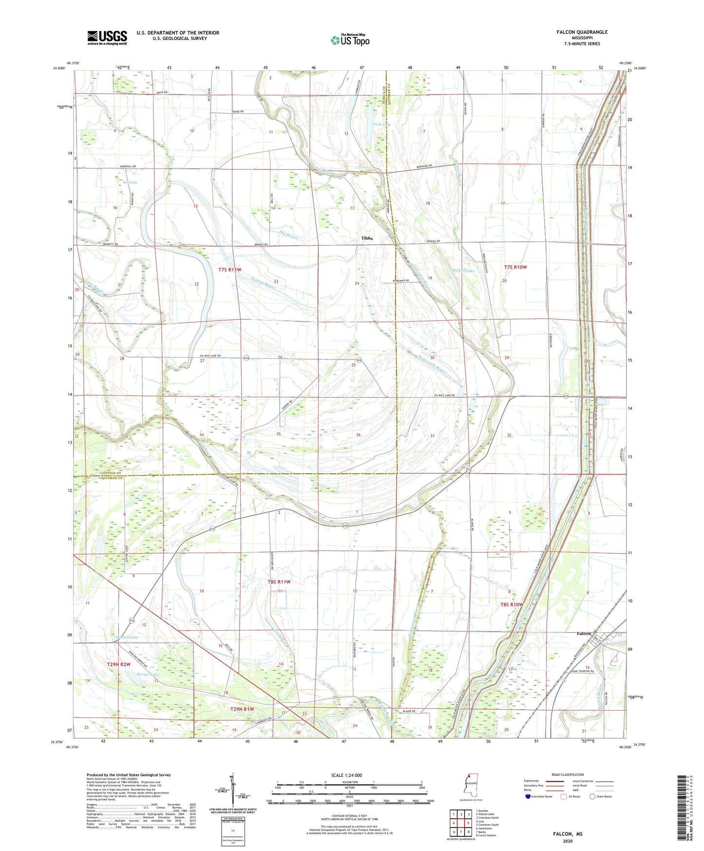
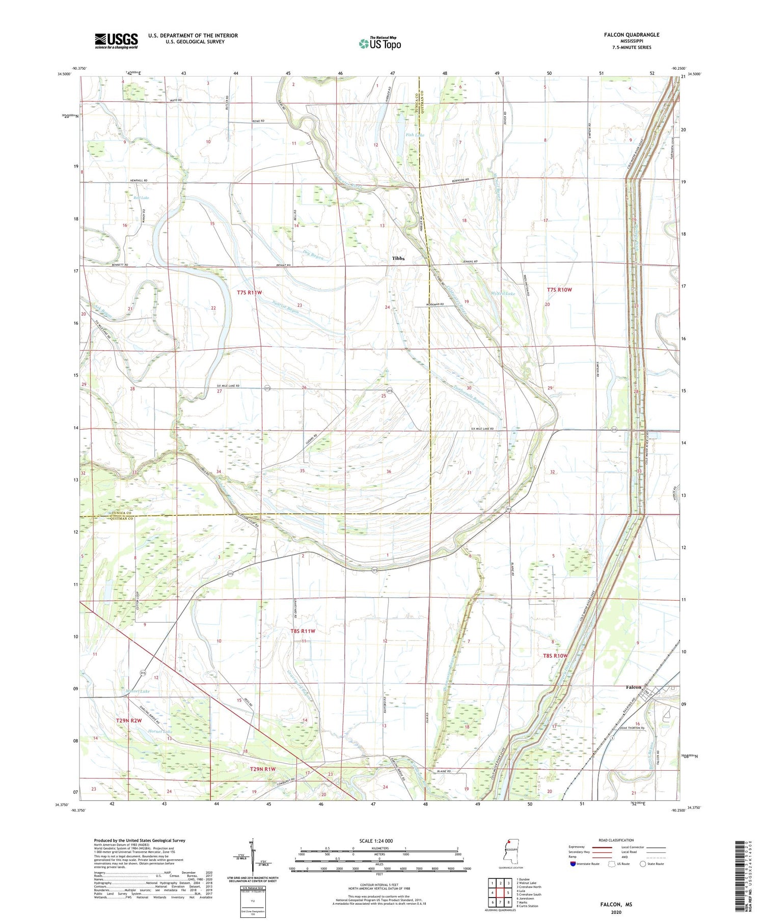
2020 topographic map quadrangle Falcon in the state of Mississippi. Scale: 1:24000. Based on the newly updated USGS 7.5' US Topo map series, this map is in the following counties: Quitman, Tunica. The map contains contour data, water features, and other items you are used to seeing on USGS maps, but also has updated roads and other features. This is the next generation of topographic maps. Printed on high-quality waterproof paper with UV fade-resistant inks.
Quads adjacent to this one:
West: Lula
Northwest: Dundee
North: Walnut Lake
Northeast: Crenshaw North
East: Crenshaw South
Southeast: Curtis Station
South: Marks
Southwest: Jonestown
Contains the following named places: Alexander Church, Ark Bayou, Dry Bayou, Falcon, Falcon School, Fish Lake, Fish Lake Church, Forked Lake, Graveyard Bayou, Green River Church, Halfmile Lake, Harvey Howze Pond Dam, Holly Grove Church, Holly Grove School, Hollywood Church, Hornet Lake, Lake City Church, Macedonia Church, McNeil Bayou, McNeil Lake, Miller Church, Mount Eva Church, Mussel Lake, Neals Chapel, Neels Ferry, New Haven Church, Oak Grove Church, Oak Grove School, Pompey Ditch, Pompey Lake, Reel Lake, Robinson Chapel, Sixmile Lake, Sunrise Bayou, Supervisor District 1, Thomasson Bayou, Tibbs, Town of Falcon, Twelvemile Bayou, Whitney Lake, ZIP Code: 38670