MyTopo
Lula Mississippi US Topo Map
Couldn't load pickup availability
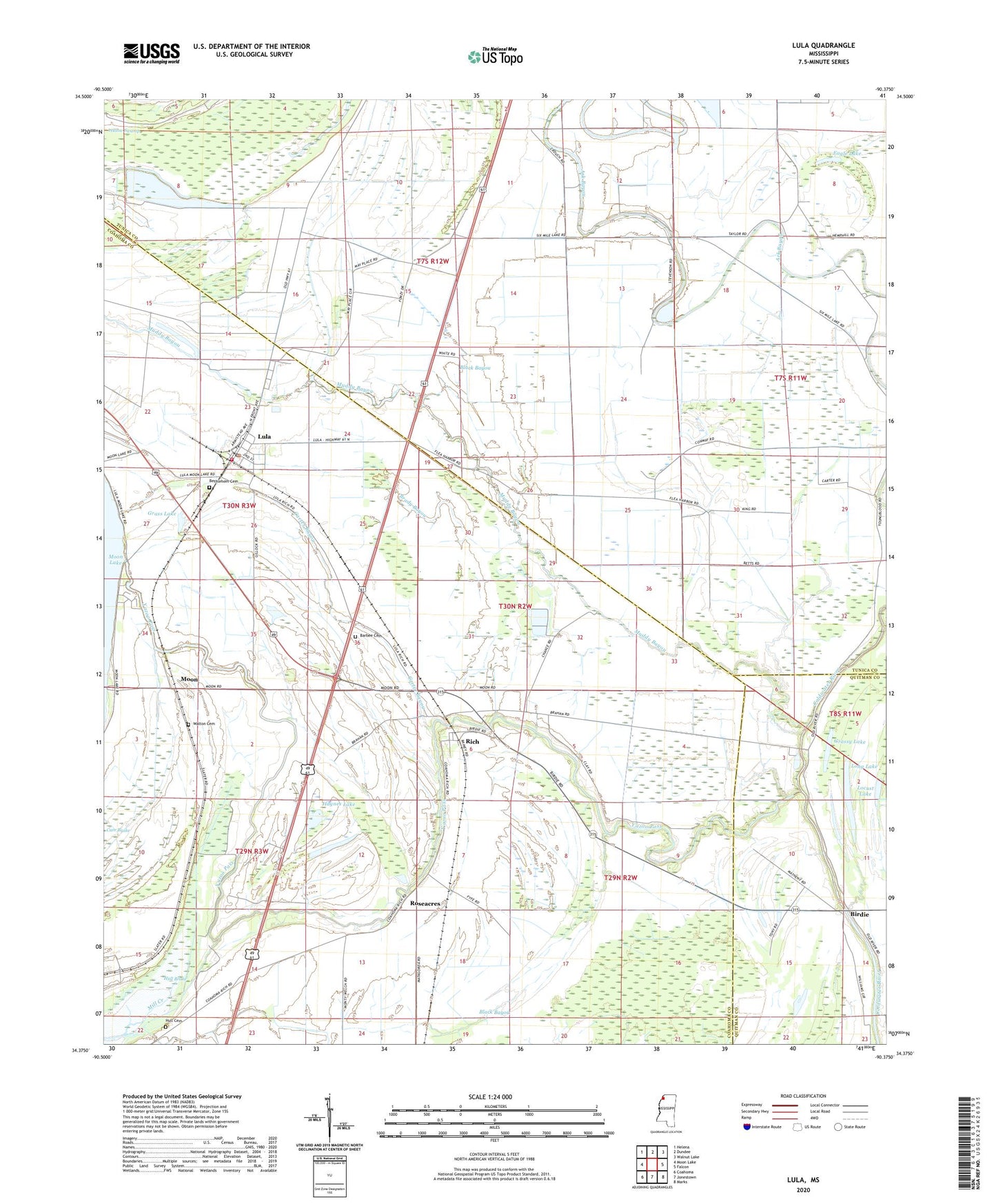
2024 topographic map quadrangle Lula in the state of Mississippi. Scale: 1:24000. Based on the newly updated USGS 7.5' US Topo map series, this map is in the following counties: Coahoma, Tunica, Quitman. The map contains contour data, water features, and other items you are used to seeing on USGS maps, but also has updated roads and other features. This is the next generation of topographic maps. Printed on high-quality waterproof paper with UV fade-resistant inks.
Quads adjacent to this one:
West: Moon Lake
Northwest: Helena
North: Dundee
Northeast: Walnut Lake
East: Falcon
Southeast: Marks
South: Jonestown
Southwest: Coahoma
This map covers the same area as the classic USGS quad with code o34090d4.
Contains the following named places: Barbee, Barbee Cemetery, Bethlehem Cemetery, Birdie, Black Bayou, Black Bayou Church, Brady Bayou, Cammack School, Carter, Carter Bayou, Coahoma County Volunteer Fire Department Lula, Dead Man Lake, Dickerson Chapel, Eagle Lake, Eleanor, Fish Lake, Flea Harbor Lake, Grass Lake, Grassy Lake, Haynes Lake, Hull Brake, Hull Cemetery, Ingram, Locust Lake, Long Lake, Lula, Lula Baptist Church, Lula Post Office, Lula -Rich Academy, Lula School, Lula United Methodist Church, Mascot, Mill Creek, Moon, Moon Lake, Mount Olive School, Mount Zion Church, Muddy Bayou, New Bethel Church, New Salem Church, Rich, Roseacres, Salem Church, Starlight Church, Strangers Rest Church, Town of Lula, Walton Cemetery, Westlake Church, Wildwood, Wildwood School, Yazoo Pass, ZIP Code: 38644