MyTopo
Thomastown Mississippi US Topo Map
Couldn't load pickup availability
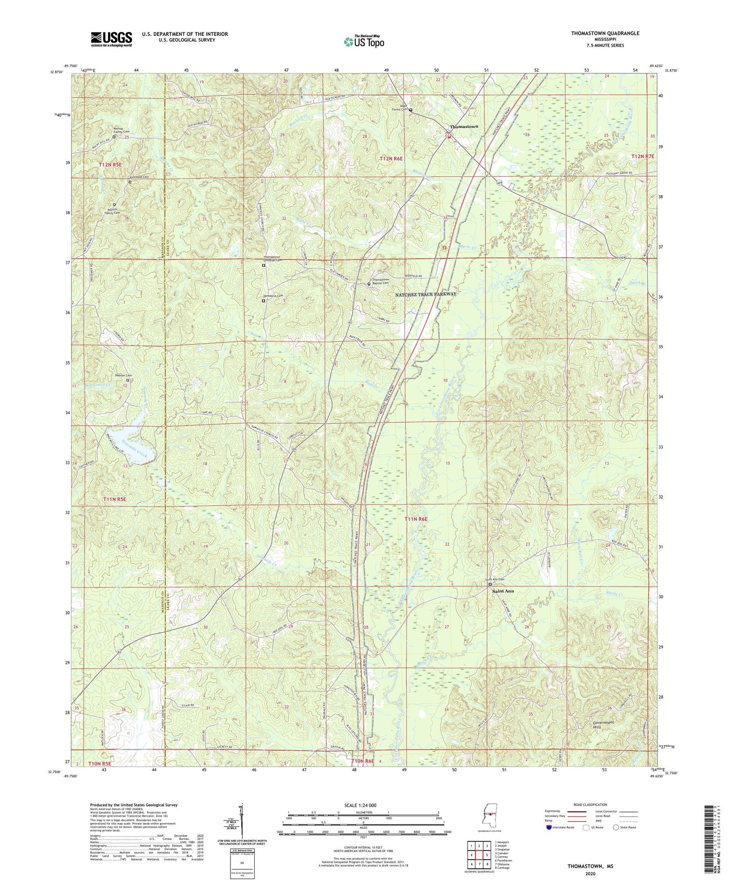
2024 topographic map quadrangle Thomastown in the state of Mississippi. Scale: 1:24000. Based on the newly updated USGS 7.5' US Topo map series, this map is in the following counties: Leake, Madison. The map contains contour data, water features, and other items you are used to seeing on USGS maps, but also has updated roads and other features. This is the next generation of topographic maps. Printed on high-quality waterproof paper with UV fade-resistant inks.
Quads adjacent to this one:
West: Camden
Northwest: Newport
North: Joseph
Northeast: Singleton
East: Conway
Southeast: Carthage
South: Ofahoma
Southwest: Farmhaven
This map covers the same area as the classic USGS quad with code o32089g6.
Contains the following named places: Adcock Family Cemetery, Bain Creek, Blailock Creek, Bourne McGehee Dam, Christian Union Church, Damascus Cemetery, Damascus Church, Hebron Church, Kernop Family Cemetery, Kirkwood, Kirkwood Cemetery, Myric Creek, New Jerusalem Church, Ninemile Creek, Old Jerusalem Church, P B Dickens Catfish Ponds Dam, Pleasant Green Church, Rambo Creek, Saint Ann, Saint Ann Cemetery, Shaui Koli Creek, Shiola Creek, Smith Creek, Supervisor District 3, Thomastown, Thomastown Attendance Center, Thomastown Baptist Cemetery, Thomastown Christian Cemetery, Thomastown Community Post Office, Thomastown Volunteer Fire Department, Wake Forest Cemetery, Wake Forest Church