MyTopo
Vance Mississippi US Topo Map
Couldn't load pickup availability
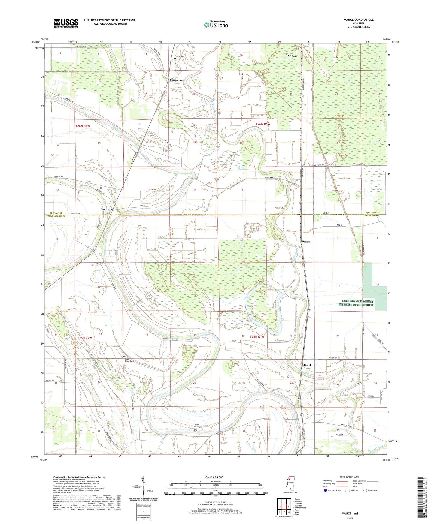
2024 topographic map quadrangle Vance in the state of Mississippi. Scale: 1:24000. Based on the newly updated USGS 7.5' US Topo map series, this map is in the following counties: Tallahatchie, Quitman. The map contains contour data, water features, and other items you are used to seeing on USGS maps, but also has updated roads and other features. This is the next generation of topographic maps. Printed on high-quality waterproof paper with UV fade-resistant inks.
Quads adjacent to this one:
West: Tutwiler
Northwest: Sabino
North: Lambert
Northeast: Crowder
East: Fishhook Lake
Southeast: Tippo
South: Webb
Southwest: Rome
This map covers the same area as the classic USGS quad with code o34090a3.
Contains the following named places: Beaver Ruin Brake, Brazil, Carr, Chancy, Cinders Band Church, Fewell, Frison Church, Goose Pond, Hiram, Johnson Cemetery, Johnson School, Little Opossum Bayou, Longstreet, Macedonia Church, Mitchner, Morning Star Church, New Hope Church, New Salem Church, Pages, Providence Church, Shady Grove Cemetery, Shady Grove School, Silent Shade Cemetery, State Penal Farm Camp B, Stover, Sturdevant Chapel, Suffer Brake, Vance, Vance Post Office, Youngs Cemetery