MyTopo
Hale Mississippi US Topo Map
Couldn't load pickup availability
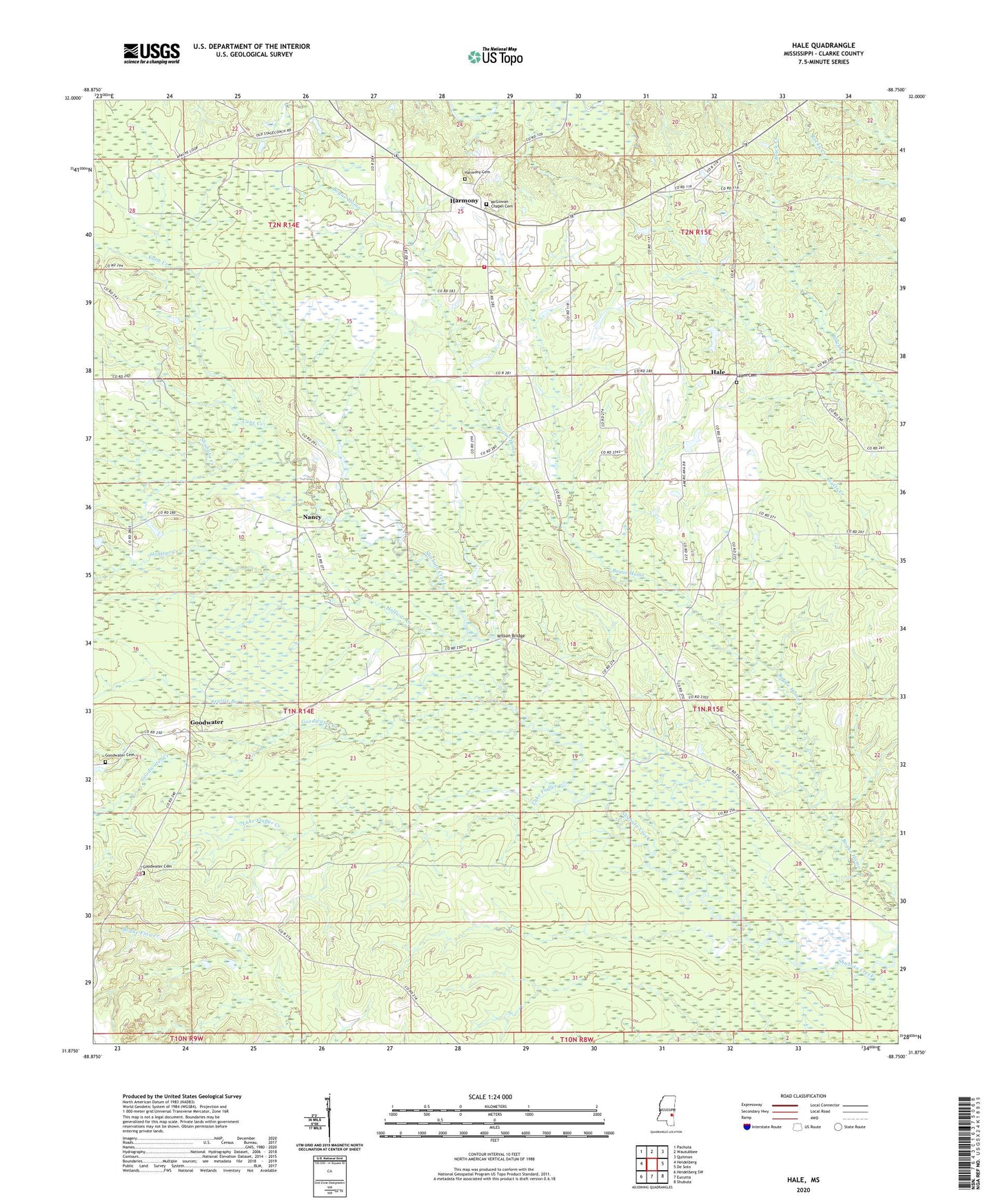
2020 topographic map quadrangle Hale in the state of Mississippi. Scale: 1:24000. Based on the newly updated USGS 7.5' US Topo map series, this map is in the following counties: Clarke. The map contains contour data, water features, and other items you are used to seeing on USGS maps, but also has updated roads and other features. This is the next generation of topographic maps. Printed on high-quality waterproof paper with UV fade-resistant inks.
Quads adjacent to this one:
West: Heidelberg
Northwest: Pachuta
North: Wautubbee
Northeast: Quitman
East: De Soto
Southeast: Shubuta
South: Eucutta
Southwest: Heidelberg SW
Contains the following named places: Cane Creek, Church of God, Coke Chapel, Compromise School, Dedwylder, East Nancy Oil Field, Evans School, Fairview Church, Fluffer Creek Oil Field, Friendship Church, George Chapel, Goodwater, Goodwater Cemetery, Goodwater Church, Goodwater Creek, Hale, Hale Oil Field, Harmony, Harmony Baptist Church, Harmony Cemetery, Harmony Oil Field, Harmony Volunteer Fire Department, Hebbiza School, Hollicar Creek, Hunters Store, John S Dabbs Pond Dam, Knight Valley Church, Luke Fluffer Creek, McGowan Chapel, McGowan Chapel Cemetery, Nancy, Nancy Oil Field, New Oak Grove Church, Pentecostal Holiness Church, Pleasant Ridge Church, Prairie Branch, Prairie Branch Oil Field, Saint Mary Church, Salem Cemetery, Salem Methodist Church, Salem School, South Harmony Oil Field, Stallings Store, Supervisor District 2, Walters School, Weems School, Wilson Bridge