MyTopo
Heidelberg SW Mississippi US Topo Map
Couldn't load pickup availability
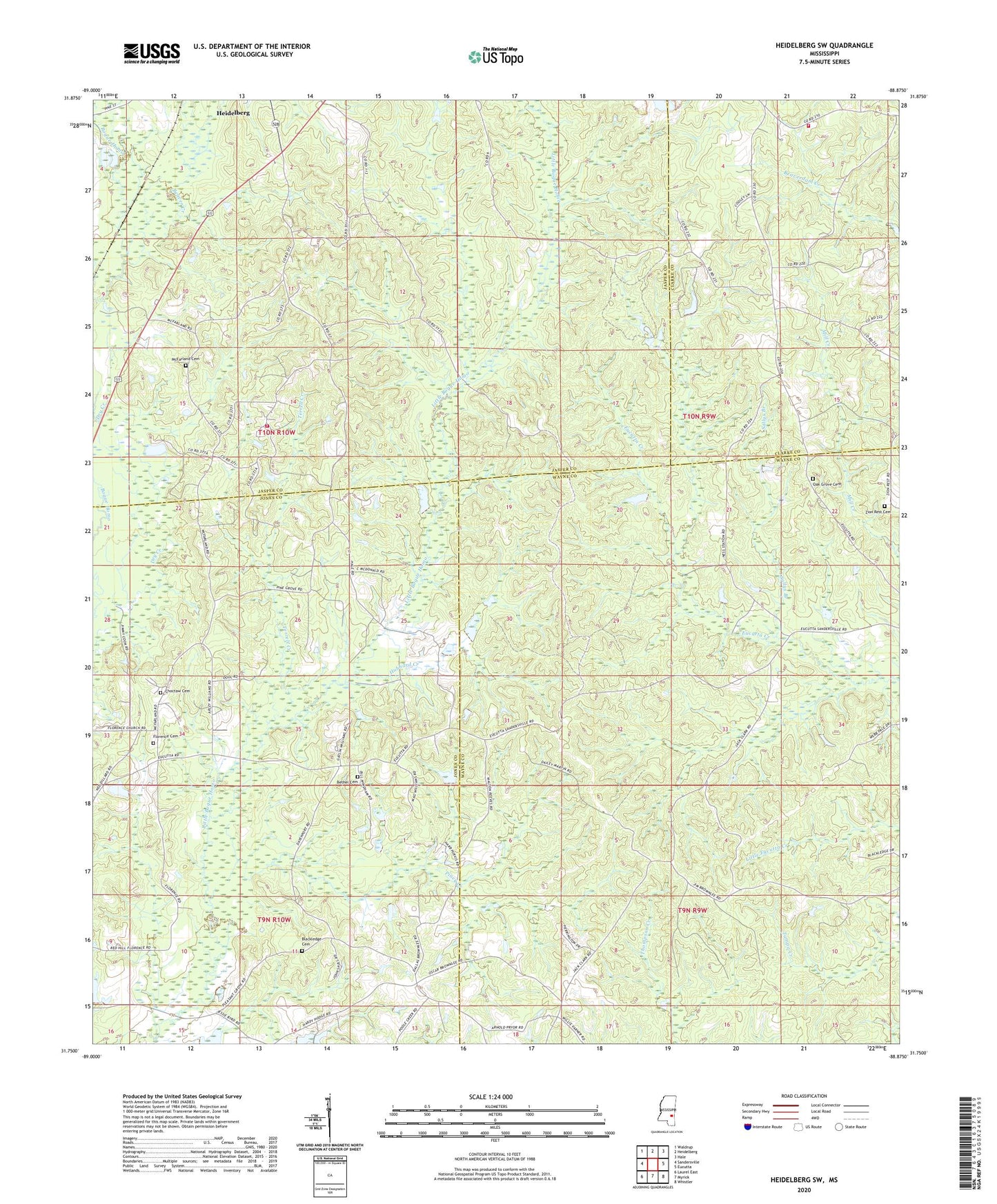
2024 topographic map quadrangle Heidelberg SW in the state of Mississippi. Scale: 1:24000. Based on the newly updated USGS 7.5' US Topo map series, this map is in the following counties: Jones, Wayne, Jasper, Clarke. The map contains contour data, water features, and other items you are used to seeing on USGS maps, but also has updated roads and other features. This is the next generation of topographic maps. Printed on high-quality waterproof paper with UV fade-resistant inks.
Quads adjacent to this one:
West: Sandersville
Northwest: Waldrup
North: Heidelberg
Northeast: Hale
East: Eucutta
Southeast: Whistler
South: Myrick
Southwest: Laurel East
This map covers the same area as the classic USGS quad with code o31088g8.
Contains the following named places: Barkley Store, Beaver Creek, Beaver Meadow Church, Beaver Meadow Volunteer Fire Department, Beaverdam School, Beaverdam Volunteer Fire Department, Bethel Cemetery, Bethel Church, Blackledge Cemetery, Bogue Homo School, Brownley Lake Dam, Bryan Oil Field, Bryant School, Choctaw Cemetery, Choctaw Church, Florence Cemetery, Florence Church, Hubbard Creek, McFarland Cemetery, McFarland Church, McGills Bridge, New Bethlehem Church, Oak Grove Cemetery, Oak Grove Church, Oak Grove School, Oakland Grove Baptist Church, Pine Grove Church, Piney Creek, Red Hill Church, Sallys Branch, Sky View Church, Taylor Line School, Terrell Creek, West Eucutta Oil Field, Zion Rest Cemetery, Zions Rest Church