MyTopo
De Soto Mississippi US Topo Map
Couldn't load pickup availability
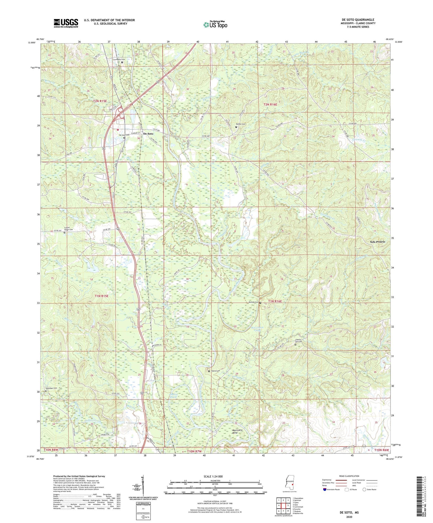
2024 topographic map quadrangle De Soto in the state of Mississippi. Scale: 1:24000. Based on the newly updated USGS 7.5' US Topo map series, this map is in the following counties: Clarke. The map contains contour data, water features, and other items you are used to seeing on USGS maps, but also has updated roads and other features. This is the next generation of topographic maps. Printed on high-quality waterproof paper with UV fade-resistant inks.
Quads adjacent to this one:
West: Hale
Northwest: Wautubbee
North: Quitman
Northeast: Sykes
East: Carmichael
Southeast: Matherville
South: Shubuta
Southwest: Eucutta
This map covers the same area as the classic USGS quad with code o31088h6.
Contains the following named places: Barber Lake, Bethea Cemetery, Bethel Cemetery, Bethel Church, Black Creek, Bogue Homo, Brown Chapel, Center Ridge Baptist Church, Center Ridge Cemetery, Center Ridge School, Church of God, Coonipper Creek, Covington Cemetery, De Soto, De Soto Baptist Church, De Soto Cemetery, De Soto Census Designated Place, Desoto Volunteer Fire Department, Duke Lake Dam, Fallen Creek, Garland Creek, Gin, Heard Cemetery, Hephzibah Church, Hepzibah Cemetery, Johnson Cutoff, Liberty Hill Cemetery, Liberty Hill Church, Little Zion Church, Little Zion School, Martinere Bend, McCormick Cutoff, Mike Creek, North Shubuta Oil Field, Oak Grove Church, Oak Grove School, Old Spring Hill Church, Polly Branch, Raymond Harris Pond Dam, Rocky Creek, Saint John School, Saint Johns Church, Sels Prairie, Shubuta Creek, Soot Creek, Spring Hill Baptist Church, Spring Hill Negro School, Starling Mill, Sumrall, Watts Creek, Winston Gate, Young Blood Creek