MyTopo
Knobtown Mississippi US Topo Map
Couldn't load pickup availability
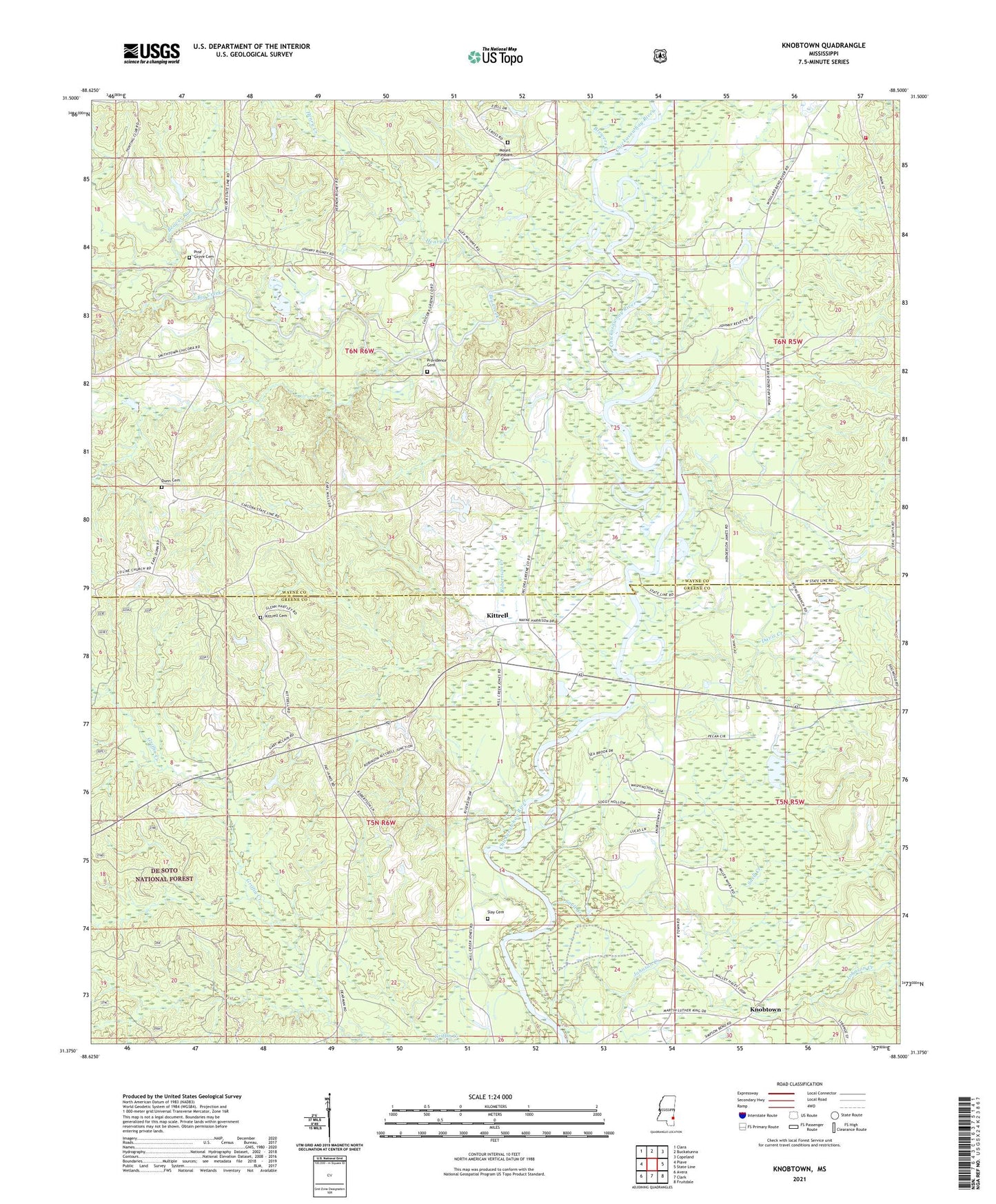
2021 topographic map quadrangle Knobtown in the state of Mississippi. Scale: 1:24000. Based on the newly updated USGS 7.5' US Topo map series, this map is in the following counties: Wayne, Greene. The map contains contour data, water features, and other items you are used to seeing on USGS maps, but also has updated roads and other features. This is the next generation of topographic maps. Printed on high-quality waterproof paper with UV fade-resistant inks.
Quads adjacent to this one:
West: Piave
Northwest: Clara
North: Buckatunna
Northeast: Copeland
East: State Line
Southeast: Fruitdale
South: Clark
Southwest: Avera
Contains the following named places: Beaver Run, Big Creek, Brewers Creek, Church of God, County Line Church, Davis Creek, Davis Creek School, Douglas Chapel, Douglass Church, Douglass School, Dunn Cemetery, Henry Creek, Horse Creek, Joe Allen Lake Dam, Johnson Creek, Kittrell, Kittrell Cemetery, Knobtown, Knobtown Volunteer Fire Department, Lucas Ferry, Mount Nebo Church, Mount Olive Church, Mount Pleasant Cemetery, Mount Pleasant Church, Pine Grove Cemetery, Pine Grove Freewill Baptist Church, Pittmans Ferry, Pleasant Ridge Church, Providence Cemetery, Providence Church, Revette Pond Dam, Robertson Creek, Slay Cemetery, Snell Creek, Wayne County Volunteer Fire Department Crossroads Station, Willards School, ZIP Code: 39362