MyTopo
Clara Mississippi US Topo Map
Couldn't load pickup availability
Also explore the Clara Forest Service Topo of this same quad for updated USFS data
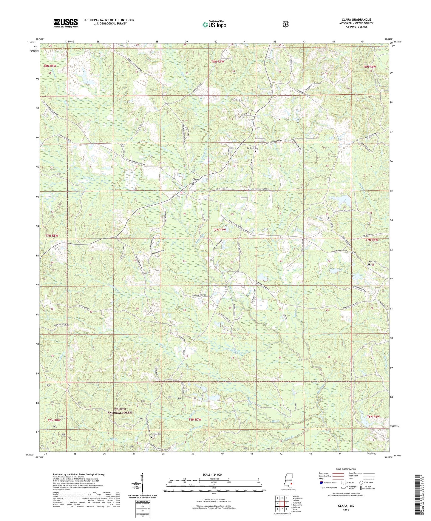
2024 topographic map quadrangle Clara in the state of Mississippi. Scale: 1:24000. Based on the newly updated USGS 7.5' US Topo map series, this map is in the following counties: Wayne. The map contains contour data, water features, and other items you are used to seeing on USGS maps, but also has updated roads and other features. This is the next generation of topographic maps. Printed on high-quality waterproof paper with UV fade-resistant inks.
Quads adjacent to this one:
West: Water Oak
Northwest: Whistler
North: Waynesboro
Northeast: Denham
East: Buckatunna
Southeast: Knobtown
South: Piave
Southwest: Mulberry
This map covers the same area as the classic USGS quad with code o31088e6.
Contains the following named places: Bazor Pond Dam, Bethel Church, Big Creek Cemetery, Big Creek Church, Clara, Clara Attendance Center, Clara Census Designated Place, Clara Church, Clara Elementary School, Clara Post Office, Clara United Methodist Church, Crawford Creek, Dry Creek, First Baptist Church of Clara, Hathorn Branch, Jones School, Long Branch, Maynor Creek, Mile Creek, Mill Creek, Mills Cemetery, Patricks School, Pittman Branch, Pittman Cemetery, Spring Hill Church, Turkey Creek, Wards School, Wayne County Volunteer Fire Department Clara Station