MyTopo
Buckatunna Mississippi US Topo Map
Couldn't load pickup availability
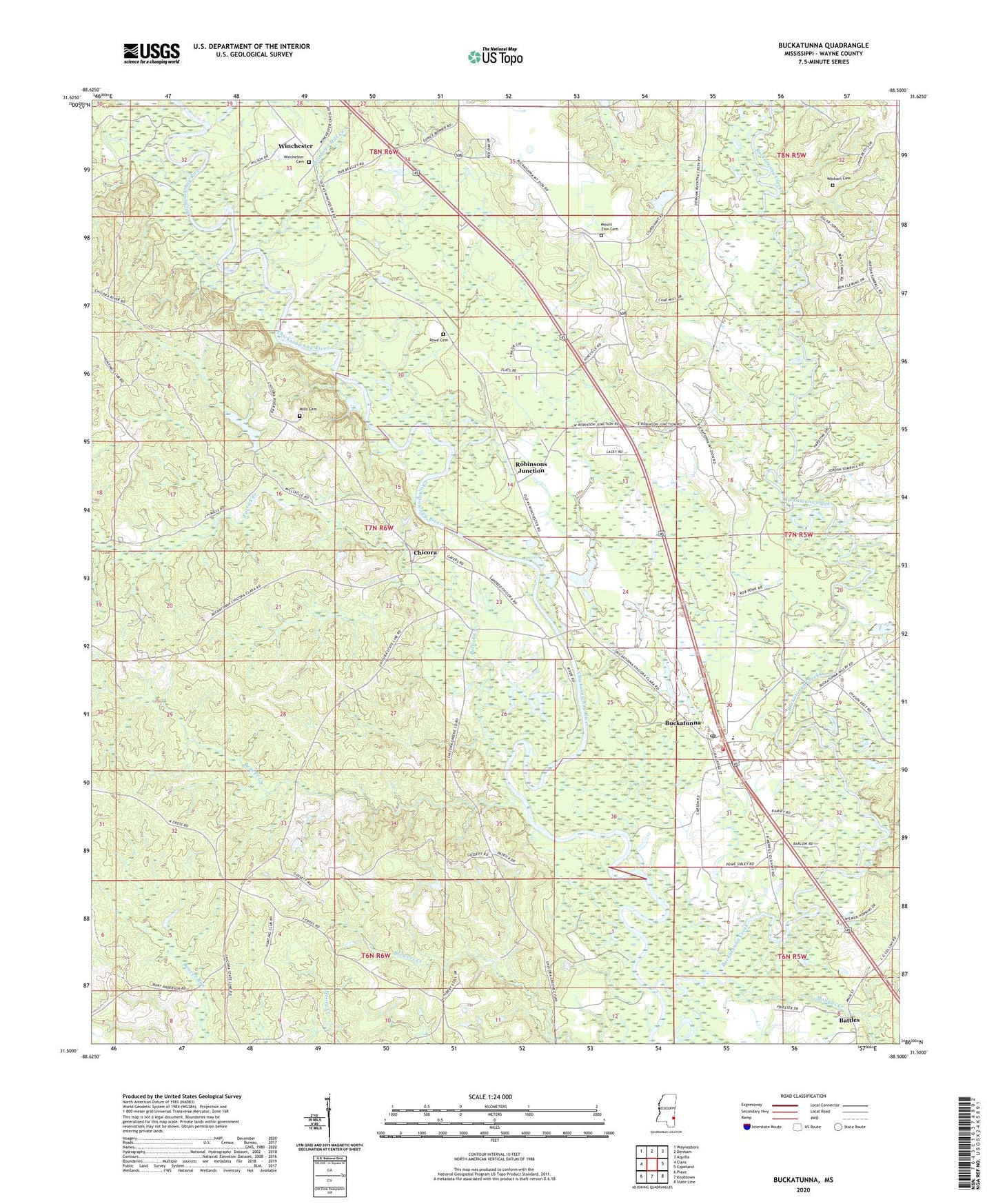
2024 topographic map quadrangle Buckatunna in the state of Mississippi. Scale: 1:24000. Based on the newly updated USGS 7.5' US Topo map series, this map is in the following counties: Wayne. The map contains contour data, water features, and other items you are used to seeing on USGS maps, but also has updated roads and other features. This is the next generation of topographic maps. Printed on high-quality waterproof paper with UV fade-resistant inks.
Quads adjacent to this one:
West: Clara
Northwest: Waynesboro
North: Denham
Northeast: Aquilla
East: Copeland
Southeast: State Line
South: Knobtown
Southwest: Piave
This map covers the same area as the classic USGS quad with code o31088e5.
Contains the following named places: African Church, Battles, Beaver Creek, Big Red Creek, Buckatunna, Buckatunna Attendance Center, Buckatunna Baptist Church, Buckatunna Census Designated Place, Buckatunna Creek, Buckatunna Methodist Church, Buckatunna Post Office, Buckatunna School, Chicora, Chicora First Baptist Church, Meadows Mill Creek, Meadows Mill Pond, Mills Cemetery, Mongus Creek, Mount Zion Cemetery, Mount Zion Church, New Light Church, Nobles Store, Patrick Creek, Pattons Ferry, Philadelphia Church, Pineville Church, Poes Ferry, Powe Cemetery, Robinsons Junction, Saint Paul Church, Supervisor District 1, Sweet Pilgrim Church, Uriel, Washam Cemetery, Wayne County Volunteer Fire Department Buckatunna Station, Winchester, Winchester Cemetery, Winchester United Methodist Church, ZIP Code: 39322