MyTopo
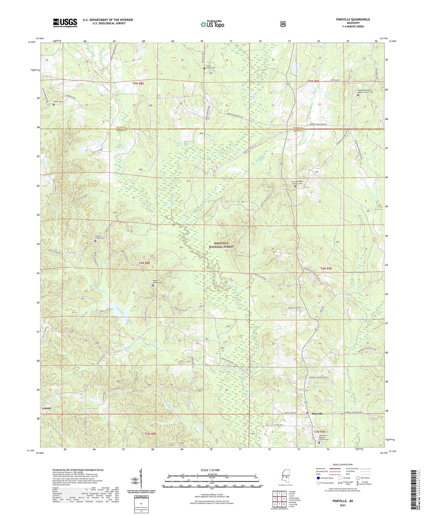
Pineville Mississippi US Topo Map
Couldn't load pickup availability
Also explore the Pineville Forest Service Topo of this same quad for updated USFS data
2024 topographic map quadrangle Pineville in the state of Mississippi. Scale: 1:24000. Based on the newly updated USGS 7.5' US Topo map series, this map is in the following counties: Smith, Scott. The map contains contour data, water features, and other items you are used to seeing on USGS maps, but also has updated roads and other features. This is the next generation of topographic maps. Printed on high-quality waterproof paper with UV fade-resistant inks.
Quads adjacent to this one:
West: Homewood
Northwest: Pulaski
North: Forest
Northeast: Lake
East: Clear Springs
Southeast: Louin
South: Louin SW
Southwest: Raleigh
This map covers the same area as the classic USGS quad with code o32089b4.
Contains the following named places: Camp Grounds School, Carr Church, Carr Methodist Church Cemetery, Galilee Church, Klein, Klein School, Leaf River Baptist Church Cemetery, Leaf River Church, Mill Branch, Mount Carmel Cemetery, Mount Carmel Church, Noblin Cemetery, O T Gilbert Pond Dam, Oak Ridge Church, Otho, Pineville, Pineville Attendance Center, Pineville Church, Pineville Volunteer Fire Department, Redhead Creek, Supervisor District 5, Tallabogue, Tishkill Creek, Turkey Creek, Union Grove Cemetery, Union Grove Church, Zula