MyTopo
Laneheart Mississippi US Topo Map
Couldn't load pickup availability
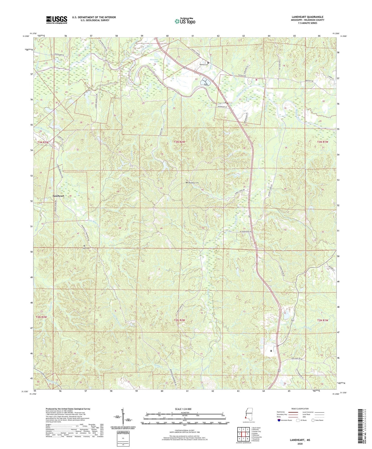
2020 topographic map quadrangle Laneheart in the state of Mississippi. Scale: 1:24000. Based on the newly updated USGS 7.5' US Topo map series, this map is in the following counties: Wilkinson. The map contains contour data, water features, and other items you are used to seeing on USGS maps, but also has updated roads and other features. This is the next generation of topographic maps. Printed on high-quality waterproof paper with UV fade-resistant inks.
Quads adjacent to this one:
West: Lessley
Northwest: Buck Island
North: Doloroso
Northeast: Garden City
East: Wilkinson
Southeast: Newtonia
South: Woodville
Southwest: Pinckneyville
Contains the following named places: Allen School, Beaver Lake, Big Piney Creek, Brush Creek, Corinth Church, Crosby Lookout Tower, Elliston School, Evening Star Church, Fords Creek, Fords Creek School, Hays Cemetery, Highway Village Church, Horseshoe Lake, J M Sessions Lake Dam, Laneheart, Little Piney Creek, Mill Creek, Morning Star Church, Pioneer Cemetery, Pioneer Church, Saint Matthew Church, Sandy Creek, Steels Creek, Supervisor District 4, Webb Lake, Westberry Cemetery, Wilkinson County, Wilkinson County Correctional Center, Wilkinson County Farm, Wilkinson Oil Field, Woodburn School, Zion Hill Church