MyTopo
Pinckneyville Mississippi US Topo Map
Couldn't load pickup availability
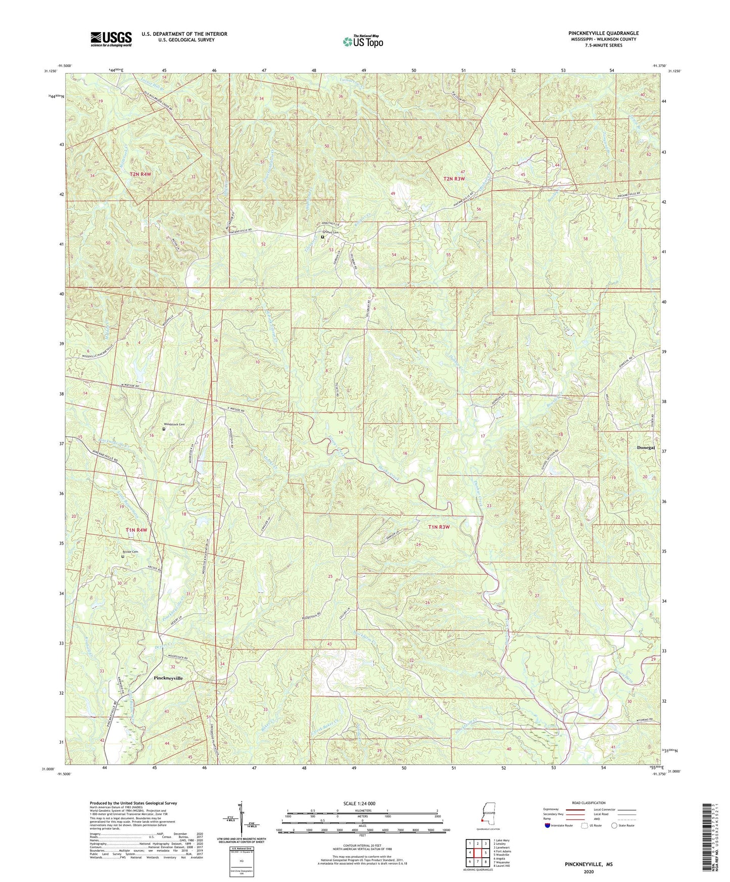
2024 topographic map quadrangle Pinckneyville in the state of Mississippi. Scale: 1:24000. Based on the newly updated USGS 7.5' US Topo map series, this map is in the following counties: Wilkinson. The map contains contour data, water features, and other items you are used to seeing on USGS maps, but also has updated roads and other features. This is the next generation of topographic maps. Printed on high-quality waterproof paper with UV fade-resistant inks.
Quads adjacent to this one:
West: Fort Adams
Northwest: Lake Mary
North: Lessley
Northeast: Laneheart
East: Woodville
Southeast: Laurel Hill
South: Weyanoke
Southwest: Angola
This map covers the same area as the classic USGS quad with code o31091a4.
Contains the following named places: Arcole Cemetery, Arcole Church, Beasley Creek, Bells Store, Desert Creek, Donegal, Dunbar Creek, Dunbar Creek Oil Field, Edgefield School, Fountainbleau Creek, Fountainbleau School, Grimes Cemetery, Highland Creek, Hooks Creek, Kaigler Creek, King Solomon Church, LaGrange School, Lewis Branch, Locust Hill Branch, Molden Creek, Moldon Plantation, Mount Zion School, Pickneyville School, Pinckneyville, Pinckneyville Creek, Primmton, Saint James Church, Saint Matthews Church, Stockfarm School, Supervisor District 2, Tanyard Branch, Tilseys Creek, Ventress Church, West Fork Tilseys Creek, Woodstock Cemetery, Woodstock Hunting Club Lake Dam, Woodstock Hunting Lake Dam, Woodstock Plantation, Wyman Church, ZIP Code: 39669